Deerwood in Crow Wing County, Minnesota — The American Midwest (Upper Plains)
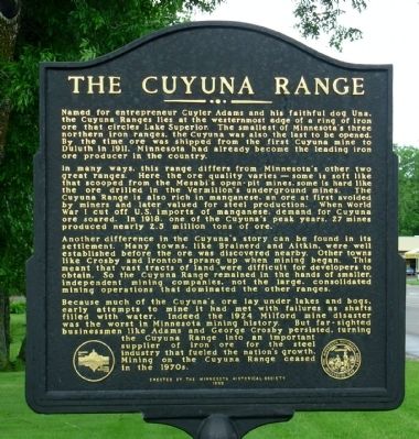
The Cuyuna Range
Photographed by Paul Fehrenbach, June 23, 2011
1. The Cuyuna Range Marker
In many ways, this range differs from Minnesota’s other two great ranges. Here the ore quality varies — some is soft like that scooped from the Mesabi’s open-pit mines, some hard like the ore drilled in the Vermillion’s underground mines. The Cuyuna Range is also rich in manganese, an ore at first avoided by miners and later valued for steel production. When World War I cut off U.S. imports of manganese, demand for Cuyuna ore soared. In 1918, one of Cuyuna’s peak years, 27 mines produced nearly 2.5 million tons of ore.
Another difference in the Cuyuna’s story can be found in its settlement. Many towns, like Brainerd and Aitkin, were well established before the ore was discovered nearby. Other towns like Crosby
this page online
Because much of the Cuyuna’s ore lay under lakes and bogs, early attempts to mine it had met with failure as shafts filled with water. Indeed the 1924 Milford mine disaster was the worst in Minnesota mining history. But far-sighted businessmen like Adams and George Crosby persisted, turning the Cuyuna Range into an important supplier of iron ore for the steel industry that fueled the nation’s growth. Mining on the Cuyuna Range ceased in the 1970s.
Erected 1999 by The Minnesota Historical Society.
Topics and series. This historical marker is listed in this topic list: Industry & Commerce. In addition, it is included in the Minnesota Historical Society series list. A significant historical year for this entry is 1911.
Location. 46° 28.425′ N, 93° 53.951′ W. Marker is in Deerwood, Minnesota, in Crow Wing County. It is at the intersection of East Front Street
Photographed by Paul Fehrenbach, June 23, 2011
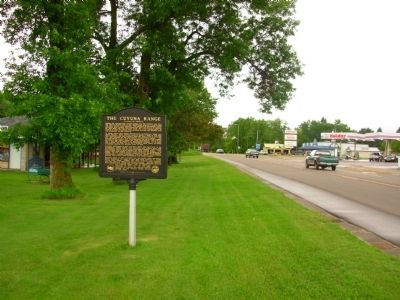
2. The Cuyuna Range Marker
Looking west along Hwy 6/210

Regionally, this marker is in the Northland. It is also in the American Midwest, in the Corn Belt, and in the Great River Road Region. Globally, it is in North America, the Great North Woods, the Western Hemisphere, the Western World, and the Anglosphere. Historically, it finds itself in what was once Rupert’s Land, the territory of the Mississippian Culture, and the Northwest Territory.
Other nearby markers. At least 8 other markers are within 3 miles of this marker, measured as the crow flies: Fitger Brewing Company (approx. 2½ miles away); Deerwood Mail Cart (approx. 2½ miles away); Soo Line Depot (approx. 2½ miles away); Croft Mine Historical Park (approx. 2.7 miles away); Crosby Veterans Memorial (approx. 2.7 miles away); Cuyuna Range Veterans Memorial (approx. 2.8 miles away); Portsmouth Mine (approx. 3 miles away); a different marker also named Portsmouth Mine (approx. 3 miles away).
Photographed by Paul Fehrenbach, June 23, 2011
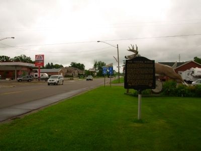
3. The Cuyuna Range Marker
Looking east along Hwy 6/210
Photographed by Paul Fehrenbach, June 23, 2011
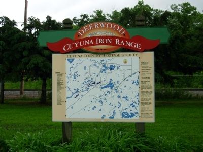
4. Cuyuna Range Heritage Society Sign
Credits. This page was last revised on June 16, 2016. It was originally submitted on June 29, 2011, by Paul Fehrenbach of Richfield, Wisconsin. This page has been viewed 1,666 times since then and 56 times this year. Photos: 1, 2, 3, 4. submitted on June 29, 2011, by Paul Fehrenbach of Richfield, Wisconsin. • Bernard Fisher was the editor who published this page.
