Near Matfield Green in Chase County, Kansas — The American Midwest (Upper Plains)
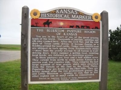
The Bluestem Pasture Region of Kansas
In these pastures are four and a half million acres. They extend from north to south across Kansas in a narrow oval, two counties wide. They comprise the last large segment of true prairie which once stretched from the forests from the East to the Great Plains. Popularly, they are known as the Flint Hills. They are better named after the two predominate grasses, Big and Little Bluestem - grasses so rich that in few other regions can so many cattle be concentrated.
Erected by American Society of Range Management and the Kansas Turnpike Authority. (Marker Number 23.)
Topics. This historical marker is listed in this topic list: Agriculture.
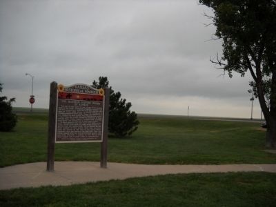
Location. 38° 5.667′ N, 96° 34.799′ W. Marker is near Matfield Green, Kansas, in Chase County. Marker is on Interstate 35 at milepost 96, on the left when traveling south. This Marker is located in the Matfield Green Rest Area south of the gas station. Touch for map. Marker is in this post office area: Matfield Green KS 66862, United States of America. Touch for directions.
Other nearby markers. At least 1 other marker is within walking distance of this marker. 38th Parallel (here, next to this marker).
Also see . . .
1. Kansas Historical Society Historical Marker Page. This is the Kansas State Historical Society Page. The Marker listed in the Matfield Green Rest Area is different that the one that is there now. (Submitted on July 9, 2011, by Thomas Onions of Olathe, Kansas.)
2. Wikipedia site on the Flint Hills. (Submitted on July 9, 2011, by Thomas Onions of Olathe, Kansas.)
Additional commentary.
1. New Replacement Marker
According to the Kansas Historical Society marker database, this marker was replaced by a new Kansas blue-and-yellow state marker in 2012. The text of the marker inscription has been revised.
— Submitted January 11, 2016, by Duane Hall of Abilene, Texas.
Credits. This page was last revised on June 16, 2016. It was originally submitted on July 9, 2011, by Thomas Onions of Olathe, Kansas. This page has been viewed 637 times since then and 16 times this year. Photos: 1, 2. submitted on July 9, 2011, by Thomas Onions of Olathe, Kansas.

