West Point in Calaveras County, California — The American West (Pacific Coastal)
West Point
Photographed by Syd Whittle, July 4, 2006
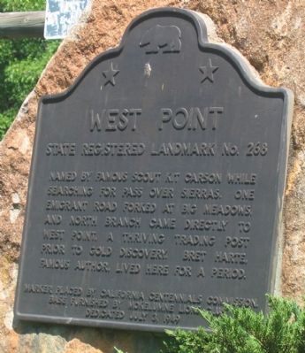
1. West Point Marker
Erected 1949 by The California Centennials Commission. Base placed by the West Point Lions Club, July 3, 1949. (Marker Number 268.)
Topics and series. This historical marker is listed in these topic lists: Exploration • Landmarks • Notable Places • Settlements & Settlers. In addition, it is included in the California Historical Landmarks series list.
Location. 38° 23.834′ N, 120° 31.66′ W. Marker is in West Point, California, in Calaveras County. It is at the intersection of State Highway 26 (State Highway 26) and Main Street, on the left when traveling east on State Highway 26. Touch for map. Marker is in this post office area: West Point CA 95255, United States of America. Touch for directions.

Regionally, this marker is in the Sierra Nevada. It is also in the American Mountain West. Globally,
this page online
Other nearby markers. At least 8 other markers are within 7 miles of this marker, measured as the crow flies: Keepers of the Land! (approx. 0.3 miles away); HOSTAGE: A most painful experience of human suffering (approx. 0.4 miles away); Sandy Gulch (approx. 1.2 miles away); Rail Road Flat (approx. 3.8 miles away); Volcano Masonic Cave (approx. 6.3 miles away); St. George Hotel (approx. 6.4 miles away); Moose Milk (approx. 6.4 miles away); General Store (approx. 6.4 miles away). Touch for a list and map of all markers in West Point.
Another marker is no longer nearby. John Doble's Cabin (was approx. 6.4 miles away but has been confirmed missing).
More about this marker. This site has been designation California Registered Historical Landmark No.268
Regarding West Point. West Point history: West Point was a "wild west" mining town during the 1849 Gold Rush in California, complete with saloons, card rooms,
Photographed by Syd Whittle, July 4, 2006
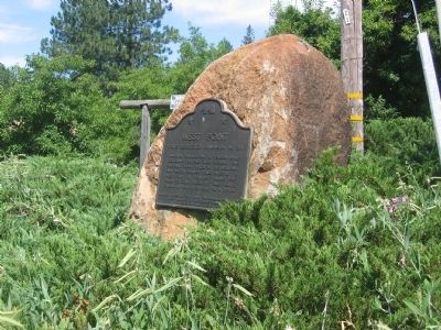
2. West Point Marker
Source: USA Cities Online
Photographed by Syd Whittle, July 4, 2006
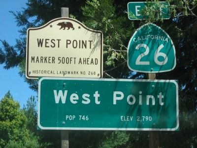
3. West Point State Historical Landmark Sign
Photographed by Syd Whittle, July 4, 2006
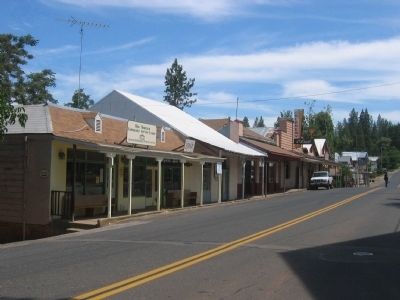
4. West Point
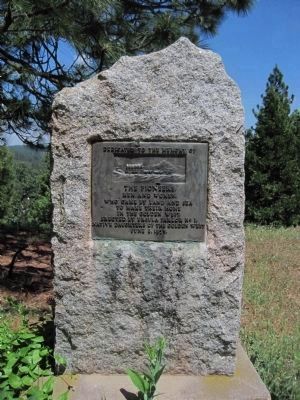
Photographed by Barry Swackhamer
5. Pioneers, Men and Women Dedication Plaque
This marker dedicated to the Pioneers was erected by Ursula Parlor No. 1, Native Daughters of the Golden West on June 8, 1955 and is located approximately 11 miles north on State Highway 88 in Pioneer.
Dedicated to the memory of
The Pioneers
Men and Women,
who came by land and sea
to make their home
in the Golden West
The Pioneers
Men and Women,
who came by land and sea
to make their home
in the Golden West
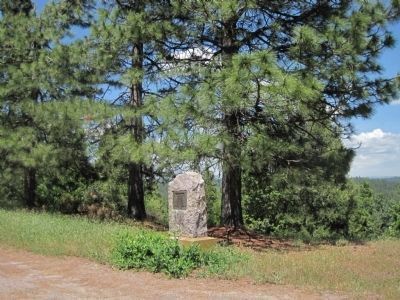
Photographed by Barry Swackhamer
6. Pioneers, Men and Women Dedication Plaque
Credits. This page was last revised on June 16, 2016. It was originally submitted on October 1, 2008, by Syd Whittle of Mesa, Arizona. This page has been viewed 2,538 times since then and 51 times this year. Last updated on July 9, 2011, by Barry Swackhamer of Brentwood, California. Photos: 1, 2, 3, 4. submitted on October 1, 2008, by Syd Whittle of Mesa, Arizona. 5, 6. submitted on July 4, 2011, by Barry Swackhamer of Brentwood, California.
