Cherryville in Gaston County, North Carolina — The American South (South Atlantic)
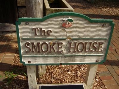
Smoke House

Photographed by Stanley and Terrie Howard, July 9, 2011
1. Smoke House Marker
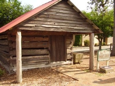
The log building was built by Benaja Black in 1847, when the area was known as White Pines. The logs are securely joined with pegs. Meat was cured here by subjecting it to dense smoke, and it was stored here during the winter or until used.
Topics. This historical marker is listed in this topic list: Settlements & Settlers. A significant historical year for this entry is 1847.
Location. 35° 22.732′ N, 81° 22.652′ W. Marker is in Cherryville, North Carolina, in Gaston County. It can be reached from South Jacob Street south of East Main Street (North Carolina Highway 279), on the left when traveling south. Touch for map. Marker is at or near this postal address: 142 S Jacob St, Cherryville NC 28021, United States of America. Touch for directions.

Regionally, this marker is in the Piedmont and in Greater Charlotte. It is also in the American South and specifically in the Upper South. Globally, it is in North America, the Western Hemisphere, the Western World, and the Anglosphere. Historically, it finds itself in what was once the territory of the Mississippian Culture, one of the original Thirteen Colonies, one
this page online
Other nearby markers. At least 8 other markers are within walking distance of this marker: City Jail (here, next to this marker); Orignal City Hall (a few steps from this marker); Federal Bonded Liquor Warehouse (a few steps from this marker); John F Black School House (within shouting distance of this marker); Cherryville City Hall (about 500 feet away, measured in a direct line); Harrelson Company Building (about 500 feet away); Cherryville Drug Company (about 500 feet away); Farmer's Bank & Trust (about 600 feet away). Touch for a list and map of all markers in Cherryville.
Photographed by Stanley and Terrie Howard, July 9, 2011
2. Smoke House Marker
Photographed by Stanley and Terrie Howard, July 9, 2011
3. Smoke House

Photographed by Stanley and Terrie Howard, July 9, 2011
4. Smoke House
Credits. This page was last revised on June 16, 2016. It was originally submitted on July 10, 2011, by Stanley and Terrie Howard of Greer, South Carolina. This page has been viewed 545 times since then and 23 times this year. Photos: 1, 2, 3, 4. submitted on July 10, 2011, by Stanley and Terrie Howard of Greer, South Carolina. • Bernard Fisher was the editor who published this page.
