Weston in Platte County, Missouri — The American Midwest (Upper Plains)
Weston, Missouri
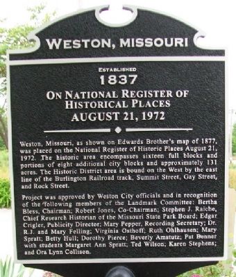
Established 1837

Photographed By William Fischer, Jr., May 28, 2011
1. Weston, Missouri Marker
Weston Downtown Historic District:
National Register of Historic Places Inventory Nomination Form
Click for more information.
National Register of Historic Places Inventory Nomination Form
Click for more information.
Weston, Missouri, as shown on Edwards Brother's map of 1877, was placed on the National Register of Historic Places August 21, 1972. The historic area encompasses sixteen full blocks and portions of eight additional city blocks and approximately 131 acres. The Historic District area is bound on the West by the east line of the Burlington Railroad track, Summit Street, Gay Street, and Rock Street.
Project was approved by Weston City officials and in recognition of the following members of the Landmark Committee: Bertha Bless, Chairman; Robert Jones, Co-Chairman; Stephen J. Raiche, Chief Research Historian of the Missouri State Park Board; Edgar Crigler, Publicity Director; Mary Pepper, Recording Secretary; Dr. R.J. and Mary Felling; Virginia Osthoff; Ruth Ohlhausen; Mary Spratt; Betty Hull; Dorothy Pierce; Beverly Amstutz; Pat Benner with students Margaret Ann Spratt; Ted Wilson; Karen Stephens; and Ora Lynn Collison.
On National Register of Historical Places
August 21, 1972
Erected by City of Weston.
Topics. This historical marker is listed in this topic list: Notable Places. A significant historical year for this entry is 1877.
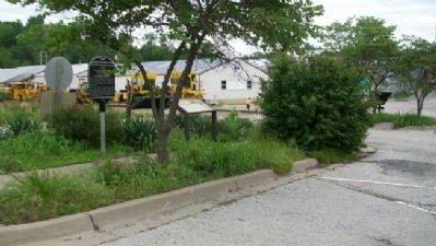
Location. 39° 24.553′ N, 94° 54.197′ W. Marker is in Weston, Missouri, in Platte County. Marker is on Main Street, on the left when traveling south. Marker is about 100 feet north of the former railroad passenger station. Touch for map. Marker is in this post office area: Weston MO 64098, United States of America. Touch for directions.
Other nearby markers. At least 8 other markers are within walking distance of this marker. The Lewis and Clark Expedition (here, next to this marker); Lewis & Clark Campsite (here, next to this marker); "Bear Medison Island" (here, next to this marker); "Hell's Half Acre" (about 600 feet away, measured in a direct line); Yocum-Benner Buildings (about 600 feet away); Doppler Building (about 800 feet away); Mitchell Building (approx. 0.2 miles away); St. George Hotel (approx. 0.2 miles away). Touch for a list and map of all markers in Weston.
Also see . . . Weston, Missouri, History. (Submitted on July 10, 2011, by William Fischer, Jr. of Scranton, Pennsylvania.)
Credits. This page was last revised on July 3, 2022. It was originally submitted on July 10, 2011, by William Fischer, Jr. of Scranton, Pennsylvania. This page has been viewed 681 times since then and 21 times this year. Photos: 1, 2. submitted on July 10, 2011, by William Fischer, Jr. of Scranton, Pennsylvania.
