Weston in Platte County, Missouri — The American Midwest (Upper Plains)
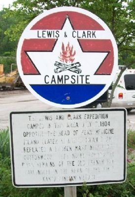
Lewis & Clark Campsite
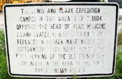
The Lewis and Clark Expedition camped in this area July 2, 1804 opposite the head of Bear Medicine Island (later Kickapoo Island) and replaced a broken mast with a cut cottonwood. They noted across the river remains of the old French fort Cavagnolle in the rear of the first Kansas Indian village.
Topics. This historical marker is listed in these topic lists: Exploration • Forts and Castles • Patriots & Patriotism • Settlements & Settlers. A significant historical month for this entry is July 1883.
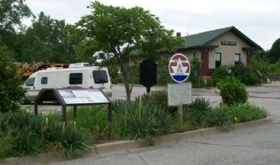
Location. 39° 24.554′ N, 94° 54.198′ W. Marker is in Weston, Missouri, in Platte County. Marker is on Main Street, on the left when traveling south. Marker is about 100 feet north of the former railroad passenger station. Touch for map. Marker is in this post office area: Weston MO 64098, United States of America. Touch for directions.
Other nearby markers. At least 8 other markers are within walking distance of this marker. Weston, Missouri (here, next to this marker); "Bear Medison Island" (here, next to this marker); The Lewis and Clark Expedition (here, next to this marker); "Hell's Half Acre" (about 600 feet away, measured in a direct line); Yocum-Benner Buildings (about 600 feet away); Doppler Building (about 800 feet away); Mitchell Building (approx. 0.2 miles away); St. George Hotel (approx. 0.2 miles away). Touch for a list and map of all markers in Weston.
Also see . . .
1. Lewis and Clark National Historic Trail. (Submitted on July 10, 2011, by William Fischer, Jr. of Scranton, Pennsylvania.)
2. Fort de Cavagnial. (Submitted on July 10, 2011, by William Fischer, Jr. of Scranton, Pennsylvania.)
Credits. This page was last revised on June 16, 2016. It was originally submitted on July 10, 2011, by William Fischer, Jr. of Scranton, Pennsylvania. This page has been viewed 467 times since then and 10 times this year. Photos: 1, 2, 3. submitted on July 10, 2011, by William Fischer, Jr. of Scranton, Pennsylvania.


