
Near Grand Forks in Unorganized Yukon, Yukon — The Northern Territories (North America)
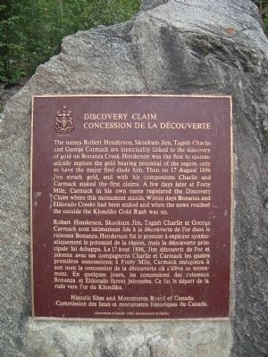
Discovery Claim
⎯⎯⎯
Concession de la Découverte
Photographed by Barry Swackhamer, August 5, 2010
1. Discovery Claim Marker

The names Robert Henderson, Skookum Jim, Tagish Charlie and George Carmack are inextricably linked to the discovery of gold on Bonanza Creek. Henderson was first to systematically explore the gold bearing potential of the region, only to have the major find elude him. Then on 17 August 1896 Jim struck gold, and with his companions Charlie and Carmack staked the first claims. A few day later at Forty Mile, Carmack in his own name registered the Discovery Claim where this monument stands. Within days Bonanza and Eldorado Creeks had been staked and when news reached the outside the Klondike Gold Rush was on.
this page online
Erected 1962 by Historic Sites and Monuments Board of Canada / Commission des lieux et monuments historiques du Canada.
Topics and series. This historical marker is listed in these topic lists: Exploration • Industry & Commerce • Natural Resources • Notable Places. In addition, it is included in the Canada, Historic Sites and Monuments Board series list. A significant historical year for this entry is 1896.
Location. 63° 55.669′ N, 139° 19.514′ W. Marker is near Grand Forks, Yukon, in Unorganized Yukon. It is on Bonanza Creek Road, on the right when traveling north. The marker is at the parking lot for the Discovery Claim Self Guiding Trail; 14.8 km/9.3 miles up Bonanza Creek Road from the intersection with the Klondike Highway. Touch for map. Marker is in this post office area: Grand Forks YT Y0B 1G0, Canada. Touch for directions.

Regionally, this marker is in the Canadian North. Globally, it is in North America, on the Ring of Fire, in the Arctic, in the Western Hemisphere, and in the Western World.
Photographed by Barry Swackhamer, August 5, 2010
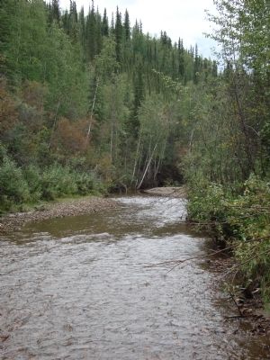
2. Bonaza Creek, upstream from the discovery site.
Other nearby markers. At least 8 other markers are within 16 kilometers of this marker, measured as the crow flies: Robert Service's Cabin / La cabane de Robert Service (approx. 15.2 kilometers away); N.W.M.P. Commanding Officer’s Quarters (approx. 15.2 kilometers away); Dr. Brown’s Residence (approx. 15.5 kilometers away); St. Andrew’s Church and Manse (approx. 15.5 kilometers away); Macaulay’s Residence / Résidence Macaulay (approx. 15.5 kilometers away); 3rd Avenue Complex (approx. 15.6 kilometers away); Yukon Hotel (approx. 15.6 kilometers away); Billy Bigg’s Blacksmith Shop (approx. 15.7 kilometers away).
Also see . . .
1. Klondike Gold Rush: Yukon Territory 1897. (Submitted on July 18, 2011, by Barry Swackhamer of Brentwood, California.)
2. Klondike Gold Rush - Wikipwdia. (Submitted on July 18, 2011, by Barry Swackhamer of Brentwood, California.)
Additional keywords. Klondike Gold Rush, gold mining
Photographed by Barry Swackhamer, August 5, 2010
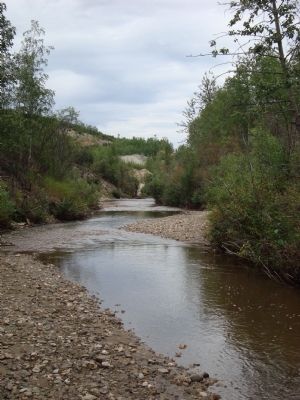
3. Bonaza Creek, downstream from the discovery site.
Photographed by Barry Swackhamer, August 5, 2010
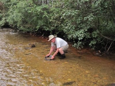
4. Trying one's luck.
Credits. This page was last revised on May 28, 2026. It was originally submitted on July 18, 2011, by Barry Swackhamer of Brentwood, California. This page has been viewed 1,020 times since then and 64 times this year. Photos: 1, 2, 3, 4. submitted on July 18, 2011, by Barry Swackhamer of Brentwood, California. • Bill Pfingsten was the editor who published this page.
