Near Abbeville in Abbeville County, South Carolina — The American South (South Atlantic)
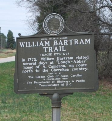
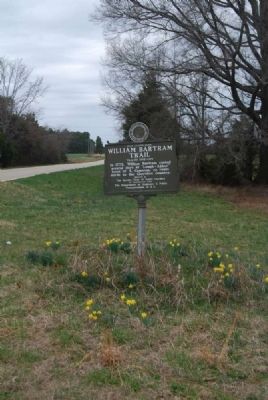
William Bartram Trail
Traced 1773-1777
— South Atlantic Region —
several days at "Lough-Abber"
home of A. Cameron, en route
north to the Cherokee country.
Erected by Garden Club of South Carolina in Cooperation with the Department of Highways & Public Transportation of S.C.
Topics and series. This historical marker is listed in these topic lists: Exploration • Native Americans. In addition, it is included in the William Bartram Trails series list. A significant historical year for this entry is 1775.
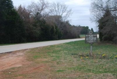
Location. 34° 12.583′ N, 82° 30.35′ W. Marker is near Abbeville, South Carolina, in Abbeville County. Marker is on State Highway 71, half a mile east of County Road 1-63. Touch for map. Marker is in this post office area: Lowndesville SC 29659, United States of America. Touch for directions.
Other nearby markers. At least 10 other markers are within 8 miles of this marker, measured as the crow flies. First Burial in Long Cane Cemetery (approx. 6.6 miles away); Long Cane Cemetery (approx. 6.6 miles away); Forest Lawn Memory Gardens Veterans Monument (approx. 7 miles away); Harbison College President's Home (approx. 7.1 miles away); W.D. Nixon Bridge (approx. 7.2 miles away); Thomas Chiles Perrin House (approx. 7.3 miles away); Abbeville's Confederate Colonels (approx. 7.3 miles away); Patrick Calhoun Burial Grounds (approx. 7.4 miles away); Burt-Stark House / Jefferson Davis’s Flight (approx. 7.4 miles away); The Last Meeting of the Confederate States Cabinet (approx. 7.4 miles away). Touch for a list and map of all markers in Abbeville.
Also see . . .
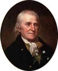
1. William Bartram. William Bartram (April 20, 1739 – July 22, 1823) was an American naturalist and author of the book popularly known as Travels. (Submitted on July 18, 2011, by Brian Scott of Anderson, South Carolina.)
2. Travels of William Bartram. William Bartram was America’s first native born naturalist/artist and the first author in the modern genre of writers who portrayed nature through personal experience as well as scientific observation. (Submitted on July 18, 2011, by Brian Scott of Anderson, South Carolina.)
3. Bartram Trail. The Bartram Trail follows the approximate route of 18th-century naturalist William Bartram’s southern journey from March, 1773 to January, 1777. (Submitted on July 18, 2011, by Brian Scott of Anderson, South Carolina.)
4. Lochaber Plantation. Alexander Cameron was granted about 2,600 acres on Penny Creek of Little River for his service in the French and Indian War. (Submitted on July 18, 2011, by Brian Scott of Anderson, South Carolina.)
Additional commentary.
1. From Bartram's Journal
"...arrived in the evening [May 10, 1775] at Mr. [Alexander] Cameron's, deputy commissary for Indian affairs for the Cherokee nation, to whom I was recommended by letters from the honourable John Stewart, superintendant, residing in Charleston, mentioning my business in the Cherokee country...The season being uncommonly wet, almost daily showers of rain and frequently attended with tremenduous thunder, rendered travelling disagreeable, toilsome and hazardous, through an uninhabited wilderness, abounding with rivers and brooks; I was prevailed upon by Mr. Cameron to stay at his house a few days, until the rains ceased and the rivers could be more easily forded...May 15th I left Lough-abber, the seat of Mr. Cameron" (Travels by William Bartram, pp. 326-328)
— Submitted July 18, 2011, by Brian Scott of Anderson, South Carolina.
2. Alexander Cameron
Alexander Cameron played a major role in the history of the area. He had come to Georgia in 1738 as a private in Oglethorpe's Forty-second Regiment. When that unit dissolved in 1749, he volunteered for service in the Independent Companies serving in South Carolina and Georgia. Cameron served in the Cherokee War, made the rank of ensign in 1761, and was stationed at Fort Prince George in the Lower Cherokee country. As a result of that service he claimed and received two thousand acres on Penny Creek. He took as his wife the daughter of the important chief of the Estatoe village, Saluy. She bore him two children, George in 1767 and Susanna in 1770. Another girl, Jane, was born in 1776 after Bartram's visit to Lochaber. Since 1768 Cameron has served as John Stuart's deputy. He has the Scots' gift of easy assimilation with the Indians; the Cherokee loved him and called him Scotchie...
Though the site of Lochaber seems isolated today, it had a busy history. Stuart and Cameron hosted a thousand Cherokees there in 1771 to set the boundary line between the Cherokees and Virginia-North Carolina in the Treaty of Lochaber. Since then various groups of Cherokees had come to call on Cameron. Cameron's main problem at the time of Bartram's visit concerned the apparent willingness of the Cherokees to barter away portions of their land. They had to give him a substantial tract on the upper Saluda River, contrary to Carolina law and the Royal Proclamation of 1763. Even though the Treaty of Lochaber stipulated that no more cessions be made without consent of the government, Richard Pearis had obtained a twelve-mile area on the upper Saluda some miles to the northeast of Lochaber. Despite the illegality of the transaction, the British government compensated Pearis for his loss of the land after the Revolution. (Source: William Bartram and the American Revolution on the Southern Frontier by Edward J. Cashin (2000), pp 136-137.)
— Submitted July 18, 2011, by Brian Scott of Anderson, South Carolina.
Credits. This page was last revised on June 16, 2016. It was originally submitted on July 18, 2011, by Brian Scott of Anderson, South Carolina. This page has been viewed 1,492 times since then and 58 times this year. Photos: 1, 2, 3, 4. submitted on July 18, 2011, by Brian Scott of Anderson, South Carolina.


