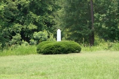
Boykin- Rembert area in Sumter County, South Carolina — The American South (South Atlantic)
Burwell Boykin / Battle of Boykins Mill
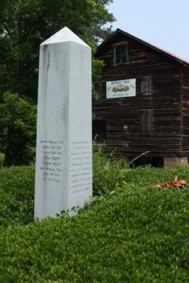
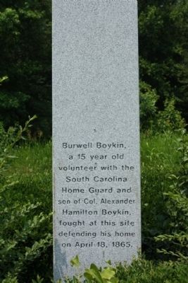
Burwell Boykin,
a 15 year old
volunteer with the
South Carolina
Home Guard and
son of Col. Alexander
Hamilton Boykin,
fought at this site
defending his home
on April 18, 1865.
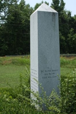
(East Face)
SC Home Guard
9th Ky Mi
53rd Ala. Cav.
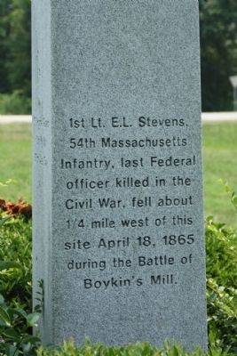
(North Face)
1st Lt. E.L. Stevens,
54th Massachusetts
Infantry, last Federal
officer killed in the
Civil War, fell about
1/4 mile west of this
site April 18, 1865
during the Battle of
Boykin's Mill.
(West Face)
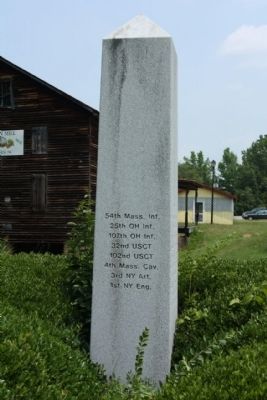
54th Mass. Inf.
25th OH Inf.
107th OH Inf.
32nd USCT
102nd USCT
4th Mass. Cav.
3rd NY Art.
1st NY Eng.
Topics. This historical marker is listed in this topic list: War, US Civil. A significant historical month for this entry is April 1803.
Location. 34° 7.833′ N, 80° 34.814′ W. Marker is in Boykin- Rembert area, South Carolina, in Sumter County. Marker is on Boykin Mill Road (State Highway 28-2) near Boykin Road (State Highway 261), on the left when traveling east. Touch for map. Marker is in this post office area: Rembert SC 29128, United States of America. Touch for directions.
Other nearby markers. At least 8 other markers are within 8 miles of this marker, measured as the crow flies. Battle of Boykin's Mill (within shouting distance of this marker); Pine Grove Plantation / Birthplace of the Boykin Spaniel (approx. 1.2 miles away); Oakland Plantation (approx. 4.8 miles away); John C. West Boyhood Home (approx. 6 miles away); The Cleveland School Fire (approx. 6½ miles away); Skirmish at Dinkins' Mill (approx. 6.6 miles away); Powder Magazine (approx. 7.2 miles away); The Loyalists (approx. 7.2 miles away).
Regarding Burwell Boykin / Battle of Boykins Mill. On April 18, 1865, Kentucky cavalry and local militia units engaged the invading northern troops as they moved south via the "King's Highway" during the Civil War campaign known as Potter's Raid. Even though our brave Confederates could do little more than delay the invaders, they did so gallantly. Burwell Boykin, the 15 year old son of Confederate Colonel Alexander Hamilton Boykin fought there, defending his home.
Sherman suspecting that Confederate supplies were being hidden in the swamps south of Camden, and although the war was obviously winding down in early April 1865, he worried that pockets of resistance could continue if the supplies reached Confederate troops. Sherman ordered the Union commander at Hilton Head to find and destroy any remaining railroad cars and locomotives in South Carolina. Union Brig. Gen. Edward E. Potter was given two brigades of troops, about twenty-six hundred men, and ordered to move inland from Georgetown, South Carolina. One of the brigades was made up of Black soldiers, including the remaining veterans of the 54th Mass. and the 32nd U.S. Colored (formerly the 1st S.C. Volunteers, the first Black regiment raised from freed slaves.)
At least twenty-two Federals were killed, including the last Federal officer killed in the war, Lt. Edward L. Stevens of the 54th Mass. Regiment. Stevens may have been smart enough to attend Harvard, but he was not smart enough to know that you do not stay astride your horse in full view of Confederate sharpshooters. He was picked off by a rifleman stationed at the church. (Source: Touring the Carolinas' Civil War Sites)
Also see . . . Battle of Boykin's Mill, Wikipedia entry. Site of the last Union officer killed in action during the American Civil War, Boykin’s Mill also hosted the final battle on South Carolina soil.
United States of America (Union) / Edward A. Potter / 2700
Confederate States of America / Stephen Elliot / Small Home Guard, 500 Cavalry
(Submitted on July 20, 2011, by Mike Stroud of Bluffton, South Carolina.)
Credits. This page was last revised on June 16, 2016. It was originally submitted on July 20, 2011, by Mike Stroud of Bluffton, South Carolina. This page has been viewed 1,636 times since then and 77 times this year. Photos: 1. submitted on July 21, 2011, by Mike Stroud of Bluffton, South Carolina. 2, 3, 4, 5, 6, 7, 8, 9, 10. submitted on July 20, 2011, by Mike Stroud of Bluffton, South Carolina.
