Lookout Mountain in Hamilton County, Tennessee — The American South (East South Central)
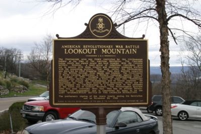
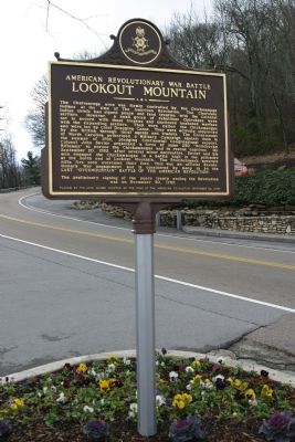
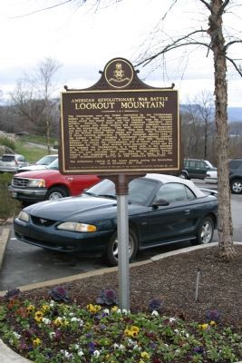
Lookout Mountain
American Revolutionary War Battle
The preliminary signing of the peace treaty ending the Revolution was on November 30, 1782.
Erected 2007 by John Sevier Chapter of the Sons of the American Revolution.
Topics and series. This historical marker is listed in these topic lists: Native Americans • War, US Revolutionary. In addition, it is included in the Sons of the American Revolution (SAR) series list. A significant historical date for this entry is September 20, 1782.
Location. 35° 1.124′ N, 85° 20.313′ W. Marker is in Lookout Mountain, Tennessee, in Hamilton County. Marker is at the intersection of Lookout Mountain Scenic Highway (Tennessee Route 148) and Jo Conn Guild, on the right when traveling north on Lookout Mountain Scenic Highway. Touch for map. Marker is in this post office area: Chattanooga TN 37409, United States of America. Touch for directions.
Other nearby markers. At least 8 other markers are within walking distance of this marker. Camp Ross (about 600 feet away, measured in a direct line); Iowa State Monument (approx. 0.3 miles away); Woods' Brigade (approx. 0.3 miles away); Williamson's Brigade (approx. 0.3 miles away); Osterhaus' Division (approx. 0.3 miles away); 84th Illinois Infantry (approx. 0.3 miles away); 75th Illinois Infantry (approx. 0.3 miles away); 92d Illinois Infantry (approx. 0.4 miles away). Touch for a list and map of all markers in Lookout Mountain.
Additional commentary.
1. A Letter By My Three-Times Great Grandfather, Dated 1785
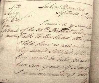
My three-times great grandfather, James McDonald, and his son joined the Montgomery Co. N.C. Militia shortly after the war in May 1784. I have a copy of a letter of his to Col. Jo. Martin while he was stationed on Lookout Mountain. It is dated September 6th, 1785.
“Lookout Mountain, Sept. 6th, 1785.
“Sir:
“I received your letter of the 30th instant, and your Talk to the head men which I told them as well as I could, they seemed satisfied, but I believe they would be better pleased to have seen yourself. I am sorry it is inconvenient at present for me to have the satisfaction of seeing you as I have trusted several young fellows that are at present out a hunting and I expect them in soon, and if I was out of their way they might deal with other people.
“I had a Letter a few days ago from the Nation in which I am informed that an Envoy had been appointed by the Court of Spain to Congress, to settle the affairs of the Grand Boundary if they can, and that the Spaniards are Resolved to keep the Americans very high up the great River, and that the Fort at Notchay is in a formidable State. Troops were arriving every day at Pensacola, all of whom were put on board light vessels and sent to Orleans from thence to all- the ports of the River.
“Upon which they are very strong, at least between 5 and 600 men and about as many more ready on any Emergency to spare from the Towns, Pensacola, Orleans and Mobeil, and that the Courts of Spain have invited 600 families of French people to settle the Notchay and other vacant Land above that, that they had actually arrived in eight Vessels to Orleans, and that there is a number of Americans already taken up at Notchay and sent provisionally to Orleans. The principals of them it is said will be hanged.
“This is all the news I have at present, however anything I can hear that I can put faith in, I shall let you know by the first opportunity, and believe me Sir, I shall never turn Spaniard.
“This is all at present, from, Sir, with true esteem,
“Your most obedient Servant,
“Jas. McDonald.”
This letter is reproduced in the North Carolina State Records, Volume XVII, Page 519. His short resignation letter, dated March 15, 1787 is also in the State Records, Volume XX, along with his son’s letter of resignation dated May 2nd 1787. By 1780 the elder McDonald moved to the newly opened territory of Montgomery County, N.C. He was a school teacher and land speculator, and possibly a farmer, recorded as owning 10 slaves in 1790.
— Submitted March 18, 2008, by Ruth M. Scruggs of Summerville, South Carolina.
Credits. This page was last revised on June 16, 2016. It was originally submitted on January 4, 2008, by R. E. Smith of Nashville, Tennessee. This page has been viewed 5,912 times since then and 197 times this year. Photos: 1, 2. submitted on February 1, 2008, by R. E. Smith of Nashville, Tennessee. 3. submitted on April 8, 2008, by Ruth M. Scruggs of Summerville, South Carolina. 4. submitted on February 1, 2008, by R. E. Smith of Nashville, Tennessee. • Craig Swain was the editor who published this page.


