Large in Jefferson Hills in Allegheny County, Pennsylvania — The American Northeast (Mid-Atlantic)
Yohogania Courthouse
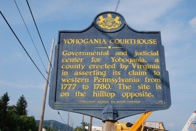
Photographed by Mike Wintermantel, July 24, 2011
1. Yohogania Courthouse Marker
Erected 1948 by Pennsylvania Historical and Museum Commission.
Topics and series. This historical marker is listed in this topic list: Government & Politics. In addition, it is included in the Pennsylvania Historical and Museum Commission (PHMC) series list. A significant historical year for this entry is 1777.
Location. 40° 15.691′ N, 79° 54.699′ W. Marker is in Jefferson Hills, Pennsylvania, in Allegheny County. It is in Large. It is on 5th Street (Pennsylvania Route 837) 0.3 miles east of Glass House Road, on the right when traveling east. Touch for map. Marker is in this post office area: West Elizabeth PA 15088, United States of America. Touch for directions.

Regionally, this marker is in Greater Pittsburgh. It is also in the American Northeast, in the Mid-Atlantic, in the Ohio River Valley, in Appalachia, and specifically in Northern Appalachia. Globally, it is in North America, the Western Hemisphere, the Western World, and
this page online
Other nearby markers. At least 8 other markers are within one mile of this marker, measured as the crow flies: Lest We Forget (approx. 0.4 miles away); Honor Roll (approx. 0.4 miles away); These We Honor (approx. 0.4 miles away); a different marker also named Lest We Forget (approx. 0.4 miles away); Monongahela River Navigation System (approx. 0.6 miles away); Elrama - Floreffe District Honor Roll (approx. one mile away); Walker House (approx. one mile away); a different marker also named West Elizabeth Honor Roll (approx. one mile away). Touch for a list and map of all markers in Jefferson Hills.
Another marker is no longer nearby. West Elizabeth Honor Roll (was approx. one mile away but has been confirmed missing).
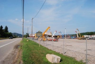
Photographed by Mike Wintermantel, July 24, 2011
2. Yohogania Courthouse Marker
Looking north on PA 837
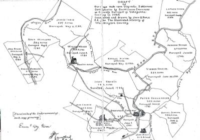
Photographed by William Crawford, circa 1882
3. Yohogania Courthouse Survey
From History of Washington County
Draft of Surveys made upon the Virginia Settlement. Cetificates by Colonel William Crawford, as County Surveyor of Yohogania County in 1780.
Credits. This page was last revised on February 2, 2023. It was originally submitted on July 24, 2011, by Mike Wintermantel of Pittsburgh, Pennsylvania. This page has been viewed 2,175 times since then and 161 times this year. Photos: 1, 2, 3. submitted on July 24, 2011, by Mike Wintermantel of Pittsburgh, Pennsylvania.
