Monongahela in Washington County, Pennsylvania — The American Northeast (Mid-Atlantic)
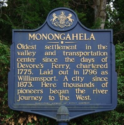
Monongahela
Erected 1947 by Pennsylvania Historical and Museum Commission.
Topics and series. This historical marker is listed in these topic lists: Settlements & Settlers • Waterways & Vessels. In addition, it is included in the Pennsylvania Historical and Museum Commission series list. A significant historical year for this entry is 1775.
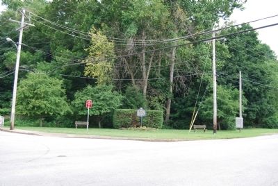
Location. 40° 12.364′ N, 79° 56.385′ W. Marker is in Monongahela, Pennsylvania, in Washington County. Marker is at the intersection of Dry Run Road (Pennsylvania Route 136) and Chess Street, on the left when traveling south on Dry Run Road. Located in a small roadside park. Touch for map. Marker is in this post office area: Monongahela PA 15063, United States of America. Touch for directions.
Other nearby markers. At least 8 other markers are within walking distance of this marker. Edward G. Acheson House (approx. 0.3 miles away); Bethel A.M.E. Church (approx. 0.4 miles away); Veterans Memorial (approx. 0.4 miles away); Jackie Ormes (approx. half a mile away); John Pietroboni (approx. half a mile away); a different marker also named Monongahela (approx. half a mile away); a different marker also named Veterans Memorial (approx. half a mile away); Company A, 110th Infantry Honor Roll (approx. half a mile away). Touch for a list and map of all markers in Monongahela.
Also see . . . City of Monongahela PA. Official Site (Submitted on July 25, 2011, by Mike Wintermantel of Pittsburgh, Pennsylvania.)
Credits. This page was last revised on June 16, 2016. It was originally submitted on July 25, 2011, by Mike Wintermantel of Pittsburgh, Pennsylvania. This page has been viewed 575 times since then and 16 times this year. Photos: 1, 2. submitted on July 25, 2011, by Mike Wintermantel of Pittsburgh, Pennsylvania.

