Monongahela in Washington County, Pennsylvania — The American Northeast (Mid-Atlantic)
The Mounds
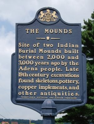
Photographed by Mike Wintermantel, July 24, 2011
1. The Mounds Marker
Erected 1948 by Pennsylvania Historical and Museum Commission.
Topics and series. This historical marker is listed in this topic list: Indigenous Peoples and Communities. In addition, it is included in the Pennsylvania Historical and Museum Commission (PHMC) series list.
Location. 40° 11.914′ N, 79° 55.953′ W. Marker is in Monongahela, Pennsylvania, in Washington County. It can be reached from the intersection of Mound Street and Indiana Street, on the right when traveling north. Located in Memorial Park. Touch for map. Marker is in this post office area: Monongahela PA 15063, United States of America. Touch for directions.

Regionally, this marker is in Greater Pittsburgh. It is also in the American Northeast, in the Mid-Atlantic, in Appalachia, and specifically in Northern Appalachia. Globally, it is in North America, the Western Hemisphere, the Western World, and
this page online
Other nearby markers. At least 8 other markers are within walking distance of this marker: U.S.S. Maine Memorial (approx. 0.4 miles away); The Hiker (approx. 0.4 miles away); First Methodist Church (approx. 0.4 miles away); John Pietroboni (approx. 0.4 miles away); Monongahela (approx. 0.4 miles away); Jackie Ormes (approx. 0.4 miles away); World War Roll of Honor (approx. 0.4 miles away); a different marker also named Monongahela (approx. half a mile away). Touch for a list and map of all markers in Monongahela.
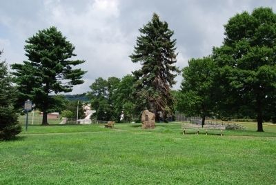
Photographed by Mike Wintermantel, July 24, 2011
2. The Mounds Marker
Credits. This page was last revised on June 16, 2016. It was originally submitted on July 25, 2011, by Mike Wintermantel of Pittsburgh, Pennsylvania. This page has been viewed 6,168 times since then and 1,191 times this year. Photos: 1, 2. submitted on July 25, 2011, by Mike Wintermantel of Pittsburgh, Pennsylvania.
