Abingdon in Washington County, Virginia — The American South (Mid-Atlantic)
Site of Black’s Fort
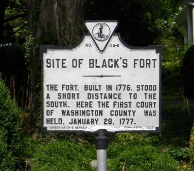
Photographed by Paul Crumlish, July 14, 2011
1. Site of Black's Fort Marker
The fort, built in 1776, stood a short distance to the south. Here the first court of Washington County was held, January 28, 1777.
Erected 1927 by Virginia Conservation & Development Commission. (Marker Number K-48.)
Topics and series. This historical marker is listed in these topic lists: Forts and Castles • Settlements & Settlers. In addition, it is included in the Virginia Department of Historic Resources (DHR) series list. A significant historical month for this entry is January 1732.
Location. 36° 42.693′ N, 81° 58.305′ W. Marker is in Abingdon, Virginia, in Washington County. It is at the intersection of Pecan Street SE and East Main Street (U.S. 11), on the right when traveling north on Pecan Street SE. Touch for map. Marker is in this post office area: Abingdon VA 24210, United States of America. Touch for directions.

Regionally, this marker is in Virginia’s Tri-Cities Area, in Southwest Virginia, and in the Blue Ridge Highlands. It is also in the American South, specifically in the Upper South, in Appalachia, and specifically in Southern Appalachia. Globally, it is in North America, the Western
this page online
Other nearby markers. At least 8 other markers are within walking distance of this marker: Sinking Spring Presbyterian Church (within shouting distance of this marker); Marcella (within shouting distance of this marker); Law Office (within shouting distance of this marker); Russell House (about 300 feet away, measured in a direct line); Col. James White House (about 400 feet away); Walnut Grove (about 500 feet away); Wolf Hills Forge (about 500 feet away); Washington County Courthouse (about 600 feet away). Touch for a list and map of all markers in Abingdon.
Also see . . . Black’s Fort remains a relevant Part of Abington history. SWVAToday website entry (Submitted on February 14, 2022, by Larry Gertner of New York, New York.)
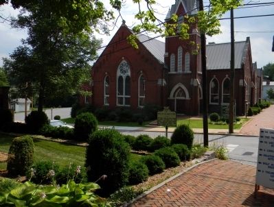
Photographed by Paul Crumlish, July 14, 2011
2. Wide view of the Site of Black's Fort Marker
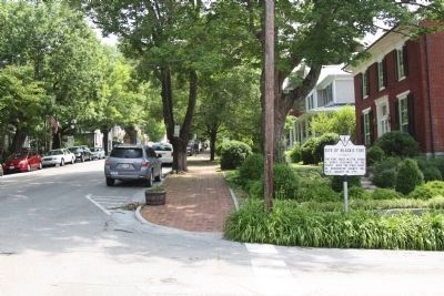
Photographed by J. J. Prats, May 29, 2011
3. Site of Black’s Fort Marker
This view is east with East Main Street on the left and Pecan Street on the right.
Credits. This page was last revised on February 2, 2023. It was originally submitted on July 25, 2011, by PaulwC3 of Northern, Virginia. This page has been viewed 2,734 times since then and 105 times this year. Photos: 1, 2. submitted on July 25, 2011, by PaulwC3 of Northern, Virginia. 3. submitted on August 20, 2011, by J. J. Prats of Powell, Ohio.
Editor’s want-list for this marker. Photo of modern day view of location of Black's Fort (36 42.553, -81 58.260) • Can you help?
