Nanticoke in Wicomico County, Maryland — The American Northeast (Mid-Atlantic)
Roaring Point Park
Photographed by Nate Davidson, July 9, 2011
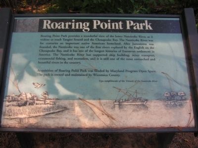
1. Roaring Point Park Marker
Roaring Point Park provides a wonderful view of the lower Nanticoke River, as it widens to reach Tangier Sound and the Chesapeake Bay. The Nanticoke River was for centuries an important native American homeland. After Jamestown was founded, the Nanticoke was one of the first rivers explored by the English on the Chesapeake Bay, and it has one of the longest histories of European settlement in America. The Nanticoke River has supported ship building, water transport, commercial fishing, and recreation, and it is still one of the most untouched and beautiful rivers in the country.
Acquisition of Roaring Point Park was funded by Maryland Program Open Space. The park is owned and maintained by Wicomico County.
Topics. This historical marker is listed in this topic list: Environment.
Location. 38° 16′ N, 75° 54.75′ W. Marker is in Nanticoke, Maryland, in Wicomico County. It can be reached from Red Hill Lane. Touch for map. Marker is in this post office area: Nanticoke MD 21840, United States of America. Touch for directions.

Regionally, this marker is on the Eastern Shore.
this page online
Other nearby markers. At least 8 other markers are within 9 miles of this marker, measured as the crow flies: A different marker also named Roaring Point Park (about 300 feet away, measured in a direct line); Henry's Beach (approx. 5½ miles away); Whitehaven (approx. 6½ miles away); Joshua Thomas (approx. 8 miles away); Old Green Hill Church (approx. 8½ miles away); Samuel Chase (approx. 8.7 miles away); "Bloomsbury" (approx. 8.8 miles away); Gen. Arnold Elzey C.S.A. (approx. 9 miles away).
Photographed by Nate Davidson, July 9, 2011
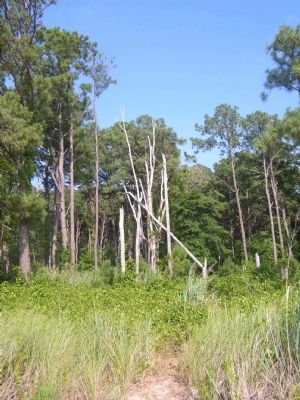
2. Roaring Point Park
Credits. This page was last revised on October 13, 2025. It was originally submitted on July 30, 2011, by Nathan Davidson of Salisbury, Maryland. This page has been viewed 1,007 times since then and 38 times this year. Photos: 1, 2. submitted on July 30, 2011, by Nathan Davidson of Salisbury, Maryland. • Bill Pfingsten was the editor who published this page.
