Marker Logo HMdb.org THE HISTORICAL
MARKER DATABASE
“Bite-Size Bits of Local, National, and Global History”
Near Philip in Haakon County, South Dakota — The American Midwest (Upper Plains)
 

Typical Sod House Homesteader


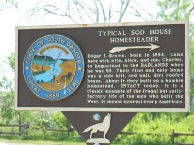
Typical Sod House Homesteader Marker image. Click for full size.
Photographed By Beverly Pfingsten, June 6, 2011
1. Typical Sod House Homesteader Marker
Inscription. Edgar I. Brown, born in 1854, came here with wife, Alice, and son, Charles, to homestead in the Badlands when he was 55. Their first and only home was a side hill, sod wall, dirt roofed house. About it they built up a humble homestead. Intact today, it is a classic example of the frugal but satisfactory life of the men who built the West. It should interest every American.
 
Topics. This historical marker is listed in these topic lists: Notable BuildingsSettlements & Settlers. A significant historical year for this entry is 1854.
 
Location. 43° 49.28′ N, 101° 54.004′ W. Marker is near Philip, South Dakota, in Haakon County. Marker is on State Highway 240, 1.3 miles south of Interstate 90, on the right when traveling south. Touch for map. Marker is in this post office area: Philip SD 57567, United States of America. Touch for directions.
 
Other nearby markers. At least 8 other markers are within 6 miles of this marker, measured as the crow flies. Civilian Conservation Corps Camps (approx. 0.3 miles away); The Badlands Wall (approx. 2˝ miles away); Anatomy of a Badland (approx. 4.1 miles away); Mako sica (approx. 4.1 miles away); Invisible Warriors (approx. 4.9 miles away); Badlands Oasis (approx. 5 miles away); Cliff Shelf Nature Trail (approx. 5.1 miles away); Saddle Pass Trail (approx. 5.7 miles away). Touch for a list and map of all markers in Philip.
 
Paid Advertisement
Click on the ad for more information.
Please report objectionable advertising to the Editor.
Click or scan to see
this page online
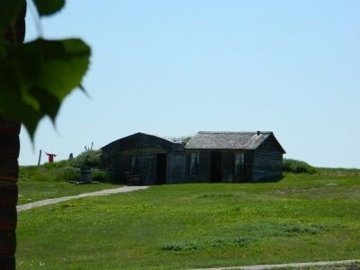
Typical Sod House image. Click for full size.
Photographed By Beverly Pfingsten, June 6, 2011
2. Typical Sod House
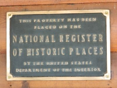
National Register of Historic Places Plaque image. Click for full size.
Photographed By Beverly Pfingsten, June 6, 2011
3. National Register of Historic Places Plaque
 
 
Credits. This page was last revised on June 16, 2016. It was originally submitted on July 30, 2011, by Bill Pfingsten of Bel Air, Maryland. This page has been viewed 831 times since then and 13 times this year. Photos:   1, 2, 3. submitted on July 30, 2011, by Bill Pfingsten of Bel Air, Maryland.
Share this page.  
Share on Tumblr
m=45288

CeraNet Cloud Computing sponsors the Historical Marker Database.
This website earns income from purchases you make after using our links to Amazon.com. We appreciate your support.
Paid Advertisement
Apr. 18, 2024