Keystone in Pennington County, South Dakota — The American Midwest (Upper Plains)
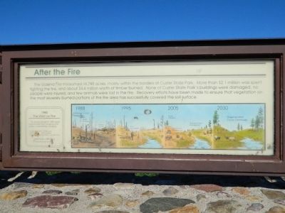
After the Fire
Photographed by Bill Pfingsten, June 7, 2011
1. After the Fire Marker
1988 The West on Fire
The severe drought of 1988 fueled massive forest fires throughout the western United States, including:
Custer State Park 16,788 acres
South Dakota 690,512 acres
Greater Yellowstone Area 1,100,000 acres
Nationwide, 1988 was a record year for fire.
IllustrationsRecovery progression following the fire 1988, 1995, 2005, 2030.
Topics. This historical marker is listed in this topic list: Disasters. A significant historical year for this entry is 1988.
Location. 43° 47.378′ N, 103° 21.052′ W. Marker is in Keystone, South Dakota, in Pennington County. It is on U.S. 16. Marker is in Custer State Park. There is an entry fee. Touch for map. Marker is in this post office
this page online

Regionally, this marker is in South Dakota’s West River, in the Badlands, and in Greater Rapid City. It is also in the American Black Hills, in the Lewis & Clark Corridor, on the prairies, and on the Northern Plains. Globally, it is in North America, the Western Hemisphere, the Western World, and the Anglosphere. Historically, it finds itself in what was once Rupert’s Land and also the Louisiana Purchase.
Other nearby markers. At least 8 other markers are within 5 miles of this marker, measured as the crow flies: The Galena Fire Chronology (here, next to this marker); Wildlife and Fire (here, next to this marker); State Game Lodge (approx. 2.3 miles away); Cecil C. Gideon (approx. 2.3 miles away); Peter Norbeck (approx. 2.3 miles away); South Dakota Game Fish & Parks (approx. 2.4 miles away); Civilian Conservation Corps Camp (approx. 4 miles away); Island in the Plains (approx. 4.1 miles away). Touch for a list and map of all markers in Keystone.
Photographed by Beverly Pfingsten, June 7, 2011
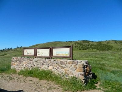
2. After the Fire Marker
Credits. This page was last revised on June 16, 2016. It was originally submitted on August 1, 2011, by Bill Pfingsten of Bel Air, Maryland. This page has been viewed 829 times since then and 31 times this year. Photos: 1, 2. submitted on August 1, 2011, by Bill Pfingsten of Bel Air, Maryland.
