Abingdon in Washington County, Virginia — The American South (Mid-Atlantic)
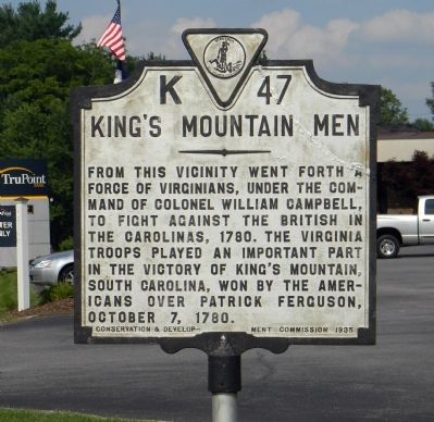
King's Mountain Men
Erected 1935 by Virginia Conservation & Development Commission. (Marker Number K-47.)
Topics and series. This historical marker is listed in this topic list: War, US Revolutionary. In addition, it is included in the Virginia Department of Historic Resources (DHR) series list. A significant historical date for this entry is October 7, 1839.
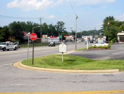
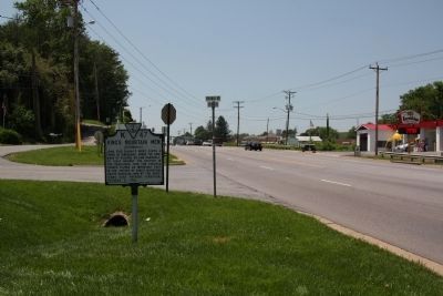
Location. 36° 42.144′ N, 82° 0.126′ W. Marker is in Abingdon, Virginia, in Washington County. Marker is at the intersection of West Main Street (U.S. 11) and Colonial Road SW, on the right when traveling north on West Main Street. Touch for map. Marker is at or near this postal address: 914 West Main Street, Abingdon VA 24210, United States of America. Touch for directions.
Other nearby markers. At least 8 other markers are within 2 miles of this marker, measured as the crow flies. Revolutionary War Muster Ground (approx. 0.4 miles away); Battle of Kings Mountain (approx. 0.4 miles away); The Chase Begins (approx. 0.4 miles away); Inciting Deadly Resistance (approx. 0.4 miles away); The Muster Grounds (approx. 0.4 miles away); Brigadier General William Edmondson “Grumble” Jones, CSA Rock (approx. 0.4 miles away); Confederate General John Hunt Morgan (approx. 1.2 miles away); Sinking Springs Cemetery Confederate Memorial (approx. 1.2 miles away). Touch for a list and map of all markers in Abingdon.
Related marker. Click here for another marker that is related to this marker. To better understand the relationship, study the marker shown.
Also see . . . Internet Archive: King's Mountain and its heroes [microform]:. history of the the battle of King's Mountain, October 7th, 1780, and the events which led up to it (Submitted on August 1, 2011, by PaulwC3 of Northern, Virginia.)
Credits. This page was last revised on February 2, 2023. It was originally submitted on August 1, 2011, by PaulwC3 of Northern, Virginia. This page has been viewed 883 times since then and 37 times this year. Photos: 1, 2. submitted on August 1, 2011, by PaulwC3 of Northern, Virginia. 3. submitted on August 20, 2011, by J. J. Prats of Powell, Ohio.


