Penokee Iron Range Trail – A Company Town
Iron County Heritage Area
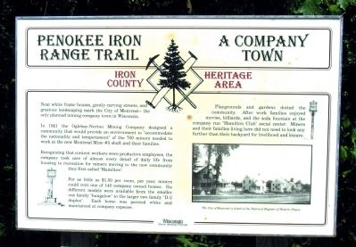
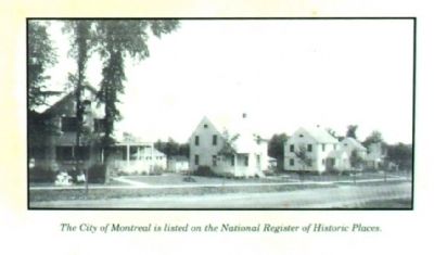
In 1921 the Oglebay-Norton Mining Company designed a community that would provide an environment to “accommodate the nationality and temperament” of the 700 miners needed to work at the new Montreal Mine #5 shaft and their families.
Recognizing that content workers were productive employees, the company took care of almost every detail of daily life from housing to recreation for miners moving to the new community they first called “Hamilton.”
For as little as $1.50 per room, per year, miners could rent one of 140 company owned homes. Six different models were available from the smaller one family “bungalow” to the larger two family “D-2 duplex.” Each home was painted white and maintained at company expense.
Playgrounds and gardens dotted the community. After work families enjoyed movies, billiards, and the soda fountain at the company run “Hamilton Club” social center. Miners and their families
this page online
Topics. This historical marker is listed in these topic lists: Industry & Commerce • Settlements & Settlers. A significant historical year for this entry is 1921.
Location. 46° 25.709′ N, 90° 14.228′ W. Marker is in Montreal, Wisconsin, in Iron County. It is at the intersection of Montreal Street and Wisconsin Avenue (Wisconsin Highway 77), on the left when traveling south on Montreal Street. Touch for map. Marker is in this post office area: Montreal WI 54550, United States of America. Touch for directions.

Regionally, this marker is in Copper Country and on the North Shore. It is also in the American Midwest and in the Corn Belt. Globally, it is in North America, the Great North Woods, the Western Hemisphere, the Western World, and the Anglosphere. Historically, it finds itself in what was once the territory of the Mississippian Culture and also the Northwest Territory.
Other nearby markers. At least 8 other markers are within 3 miles of this marker, measured as the crow flies: Penokee Iron Range Trail – Montreal Location (here,
Another marker is no longer nearby. Montreal Trails – The Montreal Mine (was approx. 0.3 miles away but has been confirmed missing).
Credits. This page was last revised on June 16, 2016. It was originally submitted on August 1, 2011, by Paul Fehrenbach of Richfield, Wisconsin. This page has been viewed 1,258 times since then and 35 times this year. Photos: 1, 2, 3. submitted on August 1, 2011, by Paul Fehrenbach of Richfield, Wisconsin. • Bill Pfingsten was the editor who published this page.
