East Portal in Mineral County, Montana — The American West (Mountains)
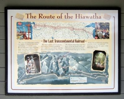
The Route of the Hiawatha
The Last Transcontinental Railroad
The Chicago, Milwaukee and St. Paul Railway’s Pacific Extension survived for 71 colorful years. Racing silk trains sped along the route, and long, rumbling troop trains carried men and materiel through four wars.
The Milwaukee’s famed electric locomotives hosted presidents and celebrities and showcased the streamlined Olympian Hiawatha passenger train.
The Route of the Hiawatha Rail-Trail, traces the most costly and difficult to build section of the railroad from Chicago to Tacoma.
Today, thousands enjoy traveling over this scenic, historic trail helping keep alive the spirit of the Milwaukee Road.
Topics. This historical marker is listed in this topic list: Railroads & Streetcars.
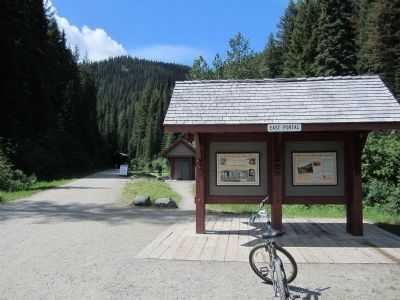
Location. 47° 23.783′ N, 115° 38.125′ W. Marker is in East Portal, Montana, in Mineral County. Marker can be reached from Rainy Creek Road (Federal Route 506) 2 miles south of Exit 5 (Taft) (Montana Highway 90). Located at the Route of the Hiawatha Trailhead. Touch for map. Marker is in this post office area: Saltese MT 59867, United States of America. Touch for directions.
Other nearby markers. At least 8 other markers are within walking distance of this marker. The Wickedest City (here, next to this marker); The Trail Follows the Trains (here, next to this marker); St. Paul Pass Tunnel (a few steps from this marker); An Unlikely Safe Haven (within shouting distance of this marker); Douse the Flames and Climb Aboard (within shouting distance of this marker); Building From the Ashes (within shouting distance of this marker); When the Mountains Roared (within shouting distance of this marker); A Battle That Could Not Be Won (within shouting distance of this marker). Touch for a list and map of all markers in East Portal.
Also see . . . Route of the Hiawatha Rail Trail. (Submitted on August 4, 2011, by Bernard Fisher of Richmond, Virginia.)
Credits. This page was last revised on June 16, 2016. It was originally submitted on August 4, 2011, by Bernard Fisher of Richmond, Virginia. This page has been viewed 703 times since then and 17 times this year. Photos: 1, 2. submitted on August 4, 2011, by Bernard Fisher of Richmond, Virginia.

