Near Avery in Shoshone County, Idaho — The American West (Mountains)
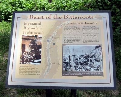
Beast of the Bitterroots
It groaned,
It growled,
It Shrieked!
Turntable & Townsite
Roland, Idaho s started as a construction camp in 1906, housing men working on the west portion of the St. Paul Pass Tunnel. It evolved from a tent camp scattered along the right-of-way, into a town of log and tar paper buildings above the mouth of the tunnel.
In 1909, the railroad built a two-story depot here and developed a railroad community around it. With the tunnel work came electric power and lights. By 1915, Roland contained a water tank, bunkhouses, depot and the infamous turntable.
Between 1916 and 1916, the population of Roland climbed to over 300 workers who were here to line St. Paul Pass Tunnel with concrete and help electrify the main line from Harlowtown, Montana to Avery, Idaho.
The last people moved from here in the early 1960’s. The railroad tore down the depot and moved the remaining bunkhouses through the tunnel for use at East Portal. The brush-covered depot foundation and the powder magazine in front of you are physical remnants of the history of the site.
Topics. This historical marker is listed in this topic list: Railroads & Streetcars. A significant historical year for this entry is 1906.
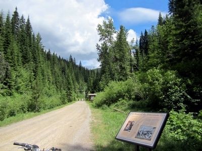
Location. 47° 22.786′ N, 115° 40.073′ W. Marker is near Avery, Idaho, in Shoshone County. Marker can be reached from Cliff Creek Road (Federal Road 506) 4 miles north of Loop Creek Road (Federal Road 326). Located along the Route of the Hiawatha Trail. Touch for map. Marker is in this post office area: Avery ID 83802, United States of America. Touch for directions.
Other nearby markers. At least 8 other markers are within 2 miles of this marker, measured as the crow flies. Rough & Tumble Camps (about 500 feet away, measured in a direct line); “Wintering” Roland (approx. ¼ mile away); The Route of the Hiawatha (approx. ¼ mile away); Water Does the Work! (approx. 1.3 miles away); Man’s Mark on the Land (approx. 1.3 miles away); A Changing Landscape (approx. 1.3 miles away); Temporary Trestles (approx. 1½ miles away); Tunneling Toward Tacoma (approx. 1½ miles away). Touch for a list and map of all markers in Avery.
More about this marker. On the left is a photo with the caption, "Roland’s hand-operated turntable, known as the “Beast”, operated with muscle and grit. It enabled snowplows, helpers and locomotives to turn around for a return trip through the St. Paul Pass Tunnel, or to head down-grade to Avery."
On the right is a photo with the caption, "This 1915 photograph, taken from the roof of the turntable looking north, shows the water tower on the left and the depot on the right. The west entrance of the St. Paul Pass Tunnel is just out of sight, around the bend in the center." Historical photograph courtesy University of Idaho Library.
Also see . . . Route of the Hiawatha Rail Trail. (Submitted on August 4, 2011, by Bernard Fisher of Richmond, Virginia.)
Credits. This page was last revised on June 16, 2016. It was originally submitted on August 4, 2011, by Bernard Fisher of Richmond, Virginia. This page has been viewed 622 times since then and 10 times this year. Photos: 1, 2. submitted on August 4, 2011, by Bernard Fisher of Richmond, Virginia.

