Near Avery in Shoshone County, Idaho — The American West (Mountains)
The Route of the Hiawatha
Photographed by Bernard Fisher, July 22, 2011
1. Route of the Hiawatha Marker
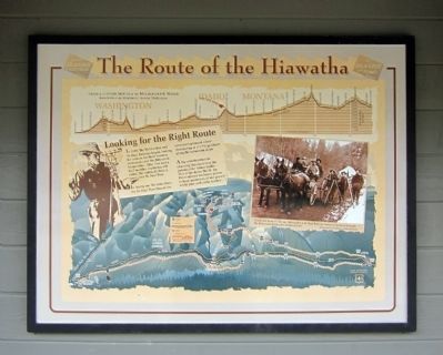
Looking for the Right Route
In 1905, the Milwaukee and St. Paul Railway began looking for a route for their western extension over the Bitterroot Mountains. After five and a half months, exploring 930 miles, the railroad chose a route over St. Paul Pass.
In laying out the route from the St. Paul Pass Tunnel the surveyors planned a line descending at a 1.7% gradient along the mountain slope
A big consideration in choosing this route was the potential for future traffic. This route down the St. Joe River offered exclusive access to huge quantities of old growth white pine and cedar timber.
Topics and series. This historical marker is listed in this topic list: Railroads & Streetcars. In addition, it is included in the Chicago, Milwaukee, St. Paul and Pacific Railroad series list. A significant historical year for this entry is 1905.
Location. 47° 22.573′ N, 115° 40.072′ W. Marker is near Avery, Idaho, in Shoshone County. It can be reached from Cliff Creek Road (Federal Road 506) 3.7 miles north of Loop Creek Road (Route 326). Located along the Route of the Hiawatha Trail. Touch for map. Marker is in this post office
this page online

Regionally, this marker is in North Idaho — Idaho’s Panhandle. It is also in the American Mountain West and specifically in the Pacific Northwest. Globally, it is in North America, the Western Hemisphere, the Western World, and the Anglosphere.
Other nearby markers. At least 8 other markers are within 2 miles of this marker, measured as the crow flies: “Wintering” Roland (here, next to this marker); Beast of the Bitterroots (approx. ¼ mile away); Rough & Tumble Camps (approx. 0.3 miles away); Water Does the Work! (approx. 1.1 miles away); Man’s Mark on the Land (approx. 1.1 miles away); A Changing Landscape (approx. 1.1 miles away); Temporary Trestles (approx. 1.3 miles away); Tunneling Toward Tacoma (approx. 1.3 miles away). Touch for a list and map of all markers in Avery.
More about this marker. On top is a "Grade & altitude profile of the Milwaukee Road from Harlowtown, Montana to Tacoma, Washington"
On the right is a photo with the caption, "A stalwart team of Chicago, Milwaukee & St. Paul Railway surveyors prepare to battle the Bitterrots during
Photographed by Bernard Fisher, July 22, 2011
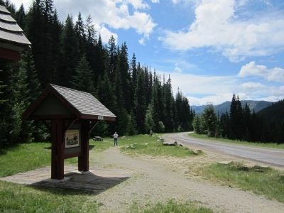
2. Route of the Hiawatha Marker at Roland
Also see . . . Route of the Hiawatha Rail Trail. (Submitted on August 4, 2011, by Bernard Fisher of Richmond, Virginia.)
Credits. This page was last revised on June 16, 2016. It was originally submitted on August 4, 2011, by Bernard Fisher of Richmond, Virginia. This page has been viewed 658 times since then and 18 times this year. Photos: 1, 2. submitted on August 4, 2011, by Bernard Fisher of Richmond, Virginia.
