Cottonwood Falls in Chase County, Kansas — The American Midwest (Upper Plains)
Connecting the Chase County Community
from the Historic Chase County Courthouse to the
— Tallgrass Prairie National Preserve —
Inscription.
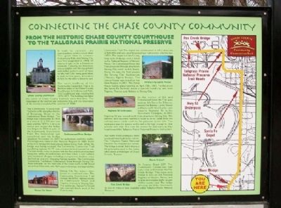
A trail to connect two communities - what a novel idea! This good idea to connect Cottonwood Falls and Strong City was first suggested in 1904. Of course it was to be a limestone sidewalk. Certainly the limestone was available and the equipment and skilled workers were at hand so why not? Like many good ideas it took several years, a hundred in fact, for the idea to become fact.
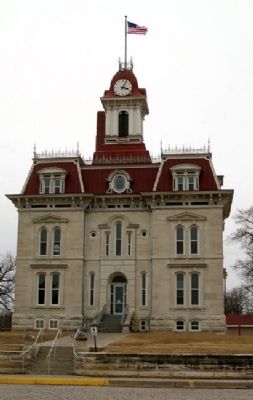
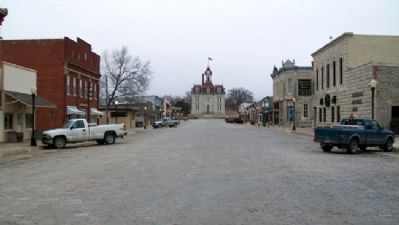
The south trailhead of the Community Connection Trail is on the front steps of the Chase County Courthouse in Cottonwood Falls. The Courthouse was constructed 1871-1873. The building has been the center of Chase County business since that time. The restoration of the exterior was completed first, with the restoration of the interior completed the summer of 2008.
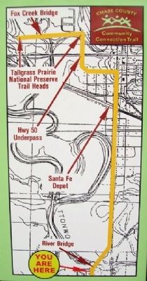
The Community Connection Trail runs north along two blocks of Broadway Street to the Cottonwood River Bridge. The bridge was constructed in 1914 at a cost of $13,700 and was used until the 1970's. A drive to restore and reopen the bridge was begun in 2004 as part of the Community Connection Trail. The restoration was completed and the bridge reopened November 22, 2007 for pedestrian and bike traffic. The bridge was listed on the National Register in 1985. North of the river bridge the trail passes Bates Grove Park. While the bridge was being restored, the Community Connection Trail paralleled highway K-177, was constructed and opened for use. The trail serves many purposes with the first and most important being the safety of pedestrians and bike riders. Local walkers and runners of all ages, including youngsters in strollers, enjoy the fresh air and ever changing Kansas weather. The Community Connection Trail follows Cottonwood Street through Strong City. Most sidewalks on the west side of the street north to 6th Street are at least 5 feet wide with ADA approved ramps and approaches.
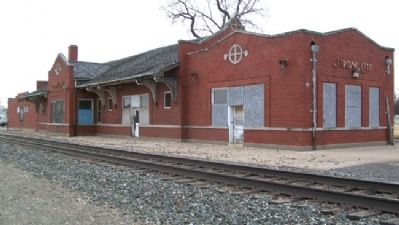
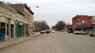
Strong City has always been known as a railroad town. The Community Connection Trail crosses the BNSF railroad tracks on Cottonwood Street and Topeka Avenue in Strong City. The authentic Santa Fe Depot sits one-half block west of the Community Connection Trail. The depot is of the County Seat style of design and is listed on the National Register of Historic Places. On Cottonwood Street the Trail proceeds through downtown Strong City north to 6th Street. Along the way the Trail passes the Strong City Auditorium (Theater, Opera House). The Opera House was listed on the State Register in 2001. The Opera House had its grand opening on April 19th, 1901. For this event the Santa Fe Railroad made a special round trip rate from Topeka, Newton and Abilene to Strong City.
At the corner of 6th and Cottonwood Street the Trail goes west on 6th Street for 3 blocks, passes
the Barney Lantry House and turns north down Lantry Lane towards Highway 50 to the Stockmans' Underpass. In 1951, Highway 50 was moved north from downtown Strong City. The farmers and ranchers needed a route to drive cattle from the railroad stock yards north to the pastures in the hills. This underpass was the answer and is said to be high enough to clear a horse with rider. It is now the answer for trail users as they head toward the Tallgrass Prairie National Preserve trail system.
Just north of the underpass there is a small hand built stone culvert. The Tallgrass Prairie National Preserve has restored this culvert. The bridge is small, but it displays the principles used in the many other stone arch bridges of Chase County, Kansas.
At County Road 227, The Community Connection Trail turns west and crosses the Fox Creek Bridge. This stone arch bridge is also on the National Register of Historic Places, and is open to everyday traffic as part of this county road. The bridge serves as one of the connections to over 41 miles of trails available within Tallgrass Prairie National Preserve.
Erected by Chase County Community Connection Trail.
Topics. This historical marker is listed in these topic lists: Bridges & Viaducts • Railroads & Streetcars
• Roads & Vehicles • Settlements & Settlers. A significant historical month for this entry is April 1822.
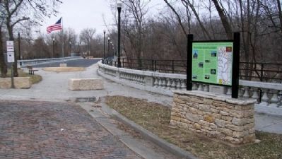
Location. 38° 22.458′ N, 96° 32.491′ W. Marker is in Cottonwood Falls, Kansas, in Chase County. Marker is at the intersection of Broadway and Mill Street, on the right when traveling north on Broadway. Marker is near the south edge of the Cottonwood River Bridge. Touch for map. Marker is in this post office area: Cottonwood Falls KS 66845, United States of America. Touch for directions.
Other nearby markers. At least 8 other markers are within walking distance of this marker. Bates Grove and the Area Adjacent to the Cottonwood River Dam (about 400 feet away, measured in a direct line); Chase County and the City of Cottonwood Falls (about 400 feet away); Cottonwood River Bridges at Cottonwood Falls (about 400 feet away); Cottonwood River Dam (about 400 feet away); Oldest Operating Courthouse in Kansas (approx. ¼ mile away); Chase County War Memorial (approx. ¼ mile away); A Landmark of Distinction (approx. ¼ mile away); Chase County All Veterans Memorial (approx. 0.6 miles away). Touch for a list and map of all markers in Cottonwood Falls.
Also see . . .
1. Strong City, Kansas. "Travel Kansas" entry (Submitted on August 4, 2011, by William Fischer, Jr. of Scranton, Pennsylvania.)
2. Tallgrass Prairie National Preserve. (Submitted on August 4, 2011, by William Fischer, Jr. of Scranton, Pennsylvania.)
3. Chase County Courthouse National Register Nomination. (Submitted on August 4, 2011, by William Fischer, Jr. of Scranton, Pennsylvania.)
4. Cottonwood River Bridge National Register Nomination. (Submitted on August 4, 2011, by William Fischer, Jr. of Scranton, Pennsylvania.)
5. Strong City Santa Fe Depot National Register Nomination. (Submitted on August 4, 2011, by William Fischer, Jr. of Scranton, Pennsylvania.)
6. Strong City Opera House State Register Nomination. (Submitted on August 4, 2011, by William Fischer, Jr. of Scranton, Pennsylvania.)
7. Fox Creek Bridge National Register Nomination. (Submitted on August 4, 2011, by William Fischer, Jr. of Scranton, Pennsylvania.)
Credits. This page was last revised on December 7, 2021. It was originally submitted on August 4, 2011, by William Fischer, Jr. of Scranton, Pennsylvania. This page has been viewed 711 times since then and 17 times this year. Photos: 1, 2, 3, 4, 5, 6, 7. submitted on August 4, 2011, by William Fischer, Jr. of Scranton, Pennsylvania.
