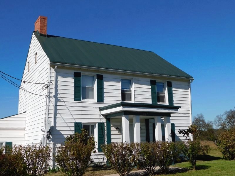
Falling Waters in Berkeley County, West Virginia — The American South (Appalachia)
Battle of Falling Waters
Crockett-Porterfield House
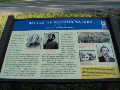
This first Civil War engagement in the Shenandoah Valley was fought here on the farm of William Rush Porterfield. Porterfield’s wife and their four children fled to the house of a nearby relative. The Fifth Virginia Infantry occupied the house and farm buildings just as the Union troops came into view; Confederate sharpshooters opened fire from the house and barn. Colonel Kenton Harper, Fifth Virginia Infantry, reported that the house and farm buildings were “key to my position.” The Federal artillery quickly replied, damaging the house and setting fire to the barn, which burned to the ground.
After Jackson’s men withdrew, Union troops immediately established a makeshift hospital in the house to care for the wounded of both sides. Although the engagement lasted for less than an hour, it devastated the property. Porterfield, a Union supporter, remained on his land and rebuilt after the war.
[ Sidebar : ]
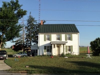
David Crocket (as he spelled his surname), the grandfather of Davy Crockett of Alamo fame, constructed the oldest section of the house of logs about 1763. The Crockets lived here less than five years before selling the property and moving to Tennessee. A description of the house written in 1941 for a Work Projects Administration travel guide described the damage that was still visible at that time.
Erected by West Virginia Civil War Trails.
Topics and series. This historical marker is listed in this topic list: War, US Civil. In addition, it is included in the West Virginia Civil War Trails series list. A significant historical date for this entry is July 2, 2002.
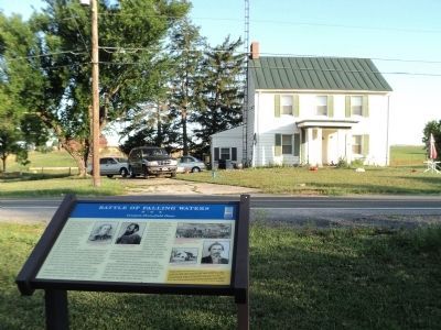
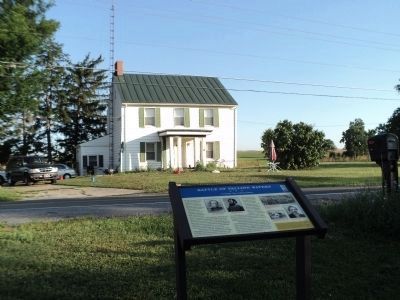
Location. Marker has been reported missing. It was located near 39° 32.733′ N, 77° 54.228′ W. Marker was in Falling Waters, West Virginia, in Berkeley County. Marker was on Williamsport Pike (U.S. 11) 0.2 miles north of West Virginia Route 901, on the right when traveling north. Marker is located across the street from the Porterfield House. Touch for map. Marker was in this post office area: Falling Waters WV 25419, United States of America. Touch for directions.
Other nearby markers. At least 8 other markers are within 2 miles
of this location, measured as the crow flies. A different marker also named Battle of Falling Waters (approx. 0.2 miles away); a different marker also named Battle of Falling Waters (approx. ¼ mile away); General “Stonewall” Jackson (approx. 0.7 miles away); a different marker also named Battle of Falling Waters (approx. 0.7 miles away); Stumpy’s Hollow (approx. 0.8 miles away); a different marker also named Battle of Falling Waters (approx. 0.8 miles away); Battle of Hoke's Run (approx. one mile away); Battles of Falling Waters (approx. 1.3 miles away). Touch for a list and map of all markers in Falling Waters.
More about this marker. Several pictures appear on the marker. These include: Portraits of Gen. Robert Patterson and Col. Thomas J. Jackson, courtesy of the Library of Congress; A picture from Harper’s Weekly July 27, 1861, entitled “Skirmish at Hoke’s Run” showing Confederates firing from the Porterfield barn; a photo of the Crockett-Porterfield House, Courtesy of the Berkley County Historical Society; and a portrait of William Rush Porterfield, Courtesy of R.E. Porterfield.
Regarding Battle of Falling Waters. It appears that the Crockett Porterfield House has been razed and the marker is gone.
Related markers. Click here for a list of markers that are related to this marker. View series of markers relating to the Battle of Falling Waters.
Credits. This page was last revised on August 31, 2021. It was originally submitted on August 4, 2011, by Bill Coughlin of Woodland Park, New Jersey. This page has been viewed 2,368 times since then and 28 times this year. Last updated on August 31, 2021, by Mary Neutzling of Canton, Ohio. Photos: 1, 2, 3, 4. submitted on August 4, 2011, by Bill Coughlin of Woodland Park, New Jersey. 5. submitted on April 8, 2021, by Bradley Owen of Morgantown, West Virginia. • Bill Pfingsten was the editor who published this page.
