Near Avery in Shoshone County, Idaho — The American West (Mountains)
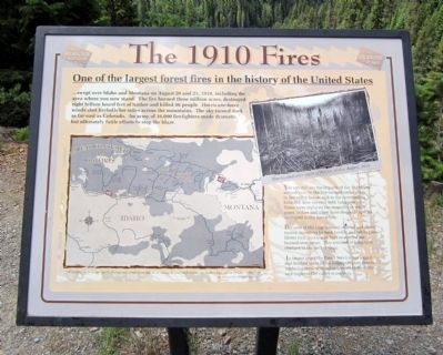
The 1910 Fires
One of the largest forest fires in the history of the United States
...swept over Idaho and Montana on August 20 and 21, 1910, including the area where you now stand. The fire burned three million acres, destroyed eight billion board feet of timber and killed 86 people. Hurricane-force winds shot fireballs for miles across the mountains. The sky turned dark as far east as Colorado. An army of 10,000 firefighters made dramatic, but ultimately futile efforts to stop the blaze.
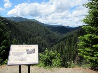
You can still see the impacts of the 1910 burn around you--in the fire-ravaged cedar snags in the valley below, and in the surrounding hillsides, now covered with lodgepole pine. These trees replaced the magnificent white pines, cedars and other more desirable species destroyed in the fierce fires.
Because of the large amount of dead and down timber, invasion by bark beetles and white pine blister rust, successive fires re-scarred the burned over areas. This resulted in long-term changes in the area ecology.
In recent years the Forest Service has logged and burned some of the lodgepole pine stands, replacing them with other species to diversify and improve the valley ecosystem.
Topics. This historical marker is listed in these topic lists: Disasters • Horticulture & Forestry • Railroads & Streetcars. A significant historical year for this entry is 1910.
Location. 47° 20.911′ N, 115° 37.904′ W. Marker is near Avery, Idaho, in Shoshone County. Marker can be reached from Cliff Creek Road (Federal Road 506) 1.8 miles north of Loop Creek Road (Federal Road 326). Located along the Route of the Hiawatha Trail. Touch for map. Marker is in this post office area: Avery ID 83802, United States of America. Touch for directions.
Other nearby markers. At least 8 other markers are within walking distance of this marker. The Big Blowup (about 600 feet away, measured in a direct line); The Olympian Hiawatha (approx. 0.3 miles away); Olympian Luxury (approx. 0.3 miles away); Little in Name Only (approx. 0.3 miles away); Bridging the Gaps (approx. 0.3 miles away); The Traveler (approx. half a mile away); No One’s “Fault” (approx. half a mile away); The Mighty Quills (approx. 0.6 miles away). Touch for a list and map of all markers in Avery.
More about this marker. On the lower left is a map with the caption, “Other fire were more deadly, but none moved as swiftly or as savagely over such a vast uncharted expanse as did the 1910 fires.” Jim Peterson, 1995, Evergreen Magazine
On the right is a photo with the caption, "Fire-blasted area south of Falcon, Idaho, August, 1910." U.S. Forest Service photograph
Also see . . .
1. 1910 Fire Commemoration Information Site. US Forest Service (Submitted on August 5, 2011, by Bernard Fisher of Richmond, Virginia.)
2. Route of the Hiawatha Rail Trail. (Submitted on August 5, 2011, by Bernard Fisher of Richmond, Virginia.)
Credits. This page was last revised on October 21, 2020. It was originally submitted on August 5, 2011, by Bernard Fisher of Richmond, Virginia. This page has been viewed 722 times since then and 17 times this year. Photos: 1, 2. submitted on August 5, 2011, by Bernard Fisher of Richmond, Virginia.

