Avery in Shoshone County, Idaho — The American West (Mountains)
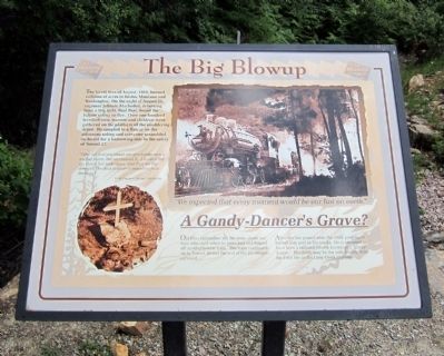
The Big Blowup
“Why, all that you could see of a bridge was a wall of flame, but we crossed it. I hooked her up, threw her wide open, and the we lay down on the deck to protect ourselves from the heat.”
Train Engineer Johnnie Mackedon
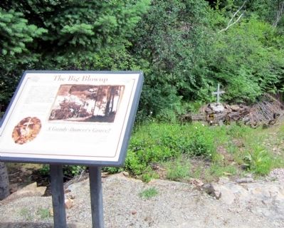
A Gandy-Dancer’s Grave?
Old time railroaders tell the story about one man who died when he panicked and leaped off another rescue train. The train continued on to tunnel 20 and the rest of the passengers survived.
After the fire passed over, the other passengers buried him next to the tracks. He is assumed to have been a railroad laborer known as a “gandy-dancer.” His death may be the only fatality from the 1910 fire in the Loop Creek drainage.
Topics. This historical marker is listed in these topic lists: Cemeteries & Burial Sites • Disasters • Railroads & Streetcars. A significant historical year for this entry is 1910.
Location. 47° 20.848′ N, 115° 37.788′ W. Marker is in Avery, Idaho, in Shoshone County. Marker can be reached from Cliff Creek Road (Federal Road 506) near Loop Creek Road (Federal Road 326). Located along the Route of the Hiawatha Trail. Touch for map. Marker is in this post office area: Avery ID 83802, United States of America. Touch for directions.
Other nearby markers. At least 8 other markers are within walking distance of this marker. The 1910 Fires (about 600 feet away, measured in a direct line); The Olympian Hiawatha (approx. ¼ mile away); Olympian Luxury (approx. ¼ mile away); The Traveler (approx. 0.3 miles away); Little in Name Only (approx. 0.4 miles away); The Mighty Quills (approx. half a mile away); Bridging the Gaps (approx. half a mile away); Johnson’s Big Cut (approx. 0.6 miles away). Touch for a list and map of all markers in Avery.
More about this marker. On the right is a photo with the caption, “We expected that every moment would be our last on earth.”
Also see . . . Route of the Hiawatha Rail Trail. (Submitted on August 5, 2011, by Bernard Fisher of Richmond, Virginia.)
Credits. This page was last revised on October 21, 2020. It was originally submitted on August 5, 2011, by Bernard Fisher of Richmond, Virginia. This page has been viewed 791 times since then and 15 times this year. Photos: 1, 2. submitted on August 5, 2011, by Bernard Fisher of Richmond, Virginia.

