Near Avery in Shoshone County, Idaho — The American West (Mountains)
This Place Had a Name?
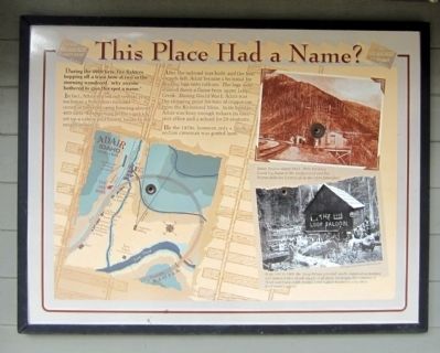
During the 1910 fires, fire fighters hopping off a train here at two in the morning wondered, “why anyone bothered to give this spot a name.”
In fact, Adair started out several years earlier as a boisterous railroad construction tent camp housing almost 400 men. Enterprising fellows quickly set up a saloon and bawdy house in the neighborhood.
After the railroad was built, and the first crowds left, Adair became a terminal for loading logs onto railcars. The logs were sluiced down a flume from upper Loop Creek. During World War I, Adair was the shipping point for tons of copper ore from the Richmond Mine. In its heyday, Adair was busy enough to have its own post office and a school for 20 students.
By the 1970s, however, only a lonely section crewman was posted here.
Topics. This historical marker is listed in this topic list: Railroads & Streetcars. A significant historical year for this entry is 1910.
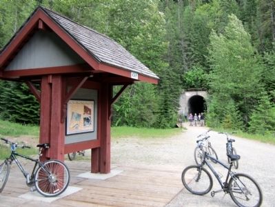
Location. 47° 20.523′ N, 115° 36.459′ W. Marker is near Avery, Idaho, in Shoshone County. Marker can be reached from Loop Creek Road (Road 326) 4 miles west of Cliff Creek Road (Federal Road 506). Located along the Route of the Hiawatha Trail. Touch for map. Marker is in this post office area: Avery ID 83802, United States of America. Touch for directions.
Other nearby markers. At least 8 other markers are within one mile of this marker, measured as the crow flies. Mountains of Copper? (here, next to this marker); Signs, Wires & Whistles (approx. 0.4 miles away); Milwaukee Road Muscle (approx. 0.6 miles away); Electrified (approx. 0.6 miles away); The Traveler (approx. 0.8 miles away); Johnson’s Big Cut (approx. 0.8 miles away); The Mighty Quills (approx. one mile away); Olympian Luxury (approx. 1.1 miles away). Touch for a list and map of all markers in Avery.
More about this marker. On the upper right is a photo with the caption, "Adair Station about 1915. Note the Loop Creek log flume in the background and the barren hillsides burned off in the 1910 forest fires."
On the lower right is a photo with the caption, "From 1907 to 1909, the Loop Saloon provided nearby construction workers and miners with a steady supply of alcoholic beverages, the company of “lewd and disreputable women,” and a place to gamble away their hard-earned money." Photograph courtesy Montana Historical Society
Also see . . . Route of the Hiawatha Rail Trail. (Submitted on August 5, 2011, by Bernard Fisher of Richmond, Virginia.)
Credits. This page was last revised on June 16, 2016. It was originally submitted on August 5, 2011, by Bernard Fisher of Richmond, Virginia. This page has been viewed 554 times since then and 16 times this year. Photos: 1, 2. submitted on August 5, 2011, by Bernard Fisher of Richmond, Virginia.

