Near Avery in Shoshone County, Idaho — The American West (Mountains)
Johnson’s Big Cut
Photographed by Bernard Fisher, July 22, 2011
1. Johnson’s Big Cut Marker
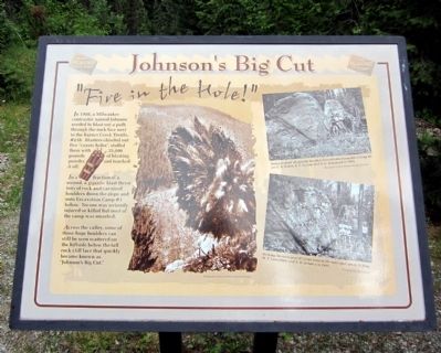
“Fire in the Hole!”
In 1908, a Milwaukee contractor named Johnson needed to blast out a path through the rock face next to the Barnes Creek Trestle, #218. Blasters chiseled out five “coyote holes”, stuffed them with 25,000 pounds of blasting powder, and touched it off.
In a fraction of a second, a gigantic blast threw tons of rock and car-sized boulders down the slope and onto Excavation Camp #1 below. No one was seriously injured or killed but most of the camp was smashed.
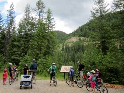
Across the valley, some of those huge boulders can still be seen scattered on the hillside below the tall rock cliff face that quickly became known as “Johnson's Big Cut.”
Topics. This historical marker is listed in this topic list: Railroads & Streetcars. A significant historical year for this entry is 1908.
Location. 47° 20.394′ N, 115° 37.493′ W. Marker is near Avery, Idaho, in Shoshone County. It can be reached from Loop Creek Road (Federal Road 326) 4 miles west of Cliff Creek Road (Federal Road 506). Located along the Route of the Hiawatha Trail. Touch for map. Marker is in this post office area: Avery
this page online

Regionally, this marker is in North Idaho — Idaho’s Panhandle. It is also in the American Mountain West and specifically in the Pacific Northwest. Globally, it is in North America, the Western Hemisphere, the Western World, and the Anglosphere.
Other nearby markers. At least 8 other markers are within walking distance of this marker: The Mighty Quills (approx. 0.2 miles away); Electrified (approx. 0.2 miles away); Milwaukee Road Muscle (approx. ¼ mile away); The Traveler (approx. 0.3 miles away); Olympian Luxury (approx. 0.4 miles away); The Olympian Hiawatha (approx. 0.4 miles away); Signs, Wires & Whistles (approx. 0.4 miles away); The Big Blowup (approx. 0.6 miles away). Touch for a list and map of all markers in Avery.
More about this marker. On the upper right is a photo with the caption, "Posing in front of gigantic boulders heaved onto Excavation Camp #1 are L.S. Oakes, E.C. Fulton, and A.C. Hammond in 1908. Photographs courtesy Montana Historical Society
On the lower right is a photo with the caption, "Striking the same pose 87 years later in the same
Photographed by Bernard Fisher, July 22, 2011
2. Johnson’s Big Cut Marker
Also see . . . Route of the Hiawatha Rail Trail. (Submitted on August 5, 2011, by Bernard Fisher of Richmond, Virginia.)
Credits. This page was last revised on June 16, 2016. It was originally submitted on August 5, 2011, by Bernard Fisher of Richmond, Virginia. This page has been viewed 867 times since then and 26 times this year. Photos: 1, 2. submitted on August 5, 2011, by Bernard Fisher of Richmond, Virginia.
