Near Avery in Shoshone County, Idaho — The American West (Mountains)
Busy Bogle Spur
Photographed by Bernard Fisher, July 22, 2011
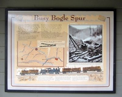
1. Busy Bogle Spur Marker
A logging railroad known as Bogle Spur snaked from here up the North Fork of the St. Joe River for seven miles. The spur was built to salvage timber killed during the 1910 fires. The little railroad operated from 1912 to 1915. When the logging railroad was abandoned the siding's name was changed to Pearson.
To move the log cars along this line, the logging contractors Bogle & Callahan purchased two 120,000-pound Shay geared locomotives.
Constructed for steep temporary logging railroads, the Shays could haul 126 tons of logs up a six percent grade. To get the log cars up from the North Fork below to the Milwaukee main line where you are now standing, Bogle & Callahan built a steep switchback connection. The operation shipped up to 30 rail cars of salvaged logs a day out of Bogle Spur. When the timber was gone the Shays were sold and the loggers moved on.
(sidebar)
The Bogle Spur Switchback
The Shay, steam powered, geared logging locomotives used on the Bogle operation produced 24,000 lbs. of tractive effort. Lima Locomotive & Machine Works of Lima, Ohio built these powerful little engines.
Pistons on the
this page online
From the 1890s, until finally being replaced by logging trucks in the 1950s, Shay engines were the most popular and numerous logging locomotives used in the western U.S.
Topics and series. This historical marker is listed in this topic list: Railroads & Streetcars. In addition, it is included in the Chicago, Milwaukee, St. Paul and Pacific Railroad series list. A significant historical year for this entry is 1910.
Location. 47° 21.114′ N, 115° 44.198′ W. Marker is near Avery, Idaho, in Shoshone County. It can be reached from Moon Pass Road (Federal Road 456) 0.4 miles south of Loop Creek Road (Federal Road 326). Located at the Route of the Hiawatha Trailhead. Touch for map. Marker is in this post office area: Avery ID 83802, United States of America. Touch for directions.

Regionally, this marker is in North Idaho — Idaho’s Panhandle. It is also in the American Mountain West and specifically in the Pacific Northwest. Globally, it is in North America,
Photographed by Bernard Fisher, July 22, 2011
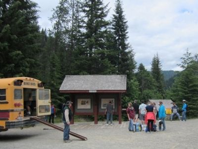
2. Route of the Hiawatha, Pearson Trailhead
Other nearby markers. At least 8 other markers are within 2 miles of this marker, measured as the crow flies: The End of the Road? (here, next to this marker); Not So "Lucky" Swedes (here, next to this marker); The Route of the Hiawatha (a few steps from this marker); Bumps on the Milwaukee Road (approx. 0.4 miles away); Rough Roads & Wrecks (approx. 0.6 miles away); Laboring in Luxury (approx. one mile away); You want to be a Ranger? (approx. 1.1 miles away); Railroad at WAR! (approx. 1½ miles away). Touch for a list and map of all markers in Avery.
More about this marker. In the center is an illustration of with the Bogel Spur Switchback with caption, "(1) Engine pushes log flats up the spur to level switchback siding...
"(2) then pulls log flats up from siding to join the Milwaukee Road mainline.
On the right is a photo with the caption, "A Shay engine pushes out the day’s first load. In the foreground, workmen wrestle a log into position for the rail-mounted boom loader to place onto a waiting flatcar."
Also see . . . Route of the Hiawatha Rail Trail. (Submitted on August 5, 2011, by Bernard Fisher of Richmond, Virginia.)
Credits. This page was last revised on June 16, 2016. It was originally submitted on August 5, 2011, by Bernard Fisher of Richmond, Virginia. This page has been viewed 1,177 times since then and 19 times this year. Photos: 1, 2. submitted on August 5, 2011, by Bernard Fisher of Richmond, Virginia.
