Santa Rosa in Guadalupe County, New Mexico — The American Mountains (Southwest)
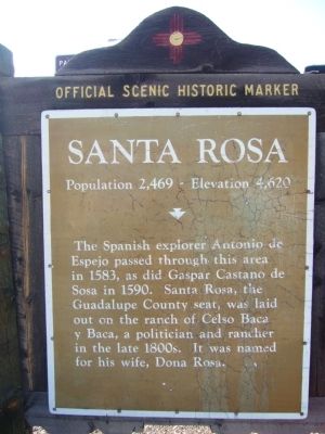
Santa Rosa
Population 2,469 - Elevation 4,620
Erected by New Mexico Historic Preservation Division.
Topics and series. This historical marker is listed in these topic lists: Exploration • Settlements & Settlers. In addition, it is included in the Antonio de Espejo Entrada of 1582-1583 series list. A significant historical year for this entry is 1583.
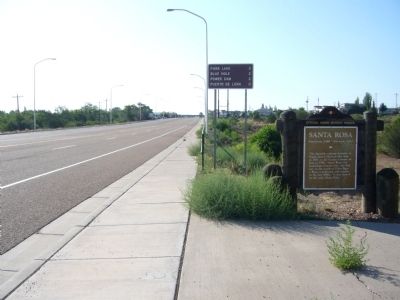
Location. 34° 56.527′ N, 104° 42.117′ W. Marker is in Santa Rosa, New Mexico, in Guadalupe County. Marker is on Coronado Avenue (U.S. 84) 0.1 miles east of Interstate 40, on the right when traveling east. Marker is just east of exit 273 from I-40. Touch for map. Marker is in this post office area: Santa Rosa NM 88435, United States of America. Touch for directions.
Other nearby markers. At least 6 other markers are within 9 miles of this marker, measured as the crow flies. A different marker also named Santa Rosa (approx. 0.6 miles away); Santa Rosa Lake State Park (approx. one mile away); Jesus M. Casaus House (approx. 1.2 miles away); a different marker also named Santa Rosa (approx. 3 miles away); Silver Moon Café (approx. 3.2 miles away); Puerto de Luna (approx. 8.9 miles away).
Credits. This page was last revised on June 16, 2016. It was originally submitted on August 9, 2011, by Bill Kirchner of Tucson, Arizona. This page has been viewed 820 times since then and 31 times this year. Photos: 1, 2, 3. submitted on August 9, 2011, by Bill Kirchner of Tucson, Arizona. • Bernard Fisher was the editor who published this page.


