Cascade near Colorado Springs in El Paso County, Colorado — The American Mountains (Southwest)
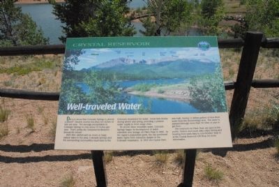
Well-traveled Water
To secure clean mountain water, Colorado springs began its development of water collection and storage on Pikeís Peak in 1891. As the regionís population grew, the city purchased water rights from resources deeper in the Colorado mountains. In 1935 the Crystal Dam was built, storing 1.1 billion gallons of Blue River water from the Breckenridge area. The water is pumped through more than 70 miles of pipe to get here. The reservoirs on Pikeís Peak are open to the public. Visitors and locals alike enjoy fishing and boating from early May to mid-October. Stop in at the Crystal Reservoir Gift Shop for more information.
Topics. This historical marker is listed in these topic lists: Natural Resources • Waterways & Vessels. A significant historical year for this entry is 1891.
Location. 38° 55.301′ N, 105° 1.549′ W. Marker is near Colorado Springs, Colorado, in El Paso County. It is in Cascade. Marker is on Pikes Peak Toll Road. Marker is located at Crystal Reservoir Visitor Center. Touch for map. Marker is in this post office area: Cascade CO 80809, United States of America. Touch for directions.
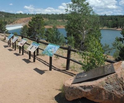
Other nearby markers. At least 8 other markers are within 3 miles of this marker, measured as the crow flies. Test Your Bird I.Q. (here, next to this marker); The Making of America's Mountain (here, next to this marker); A Mountain of Many Names (here, next to this marker); Take a Closer Look...Foothills Life Zone (here, next to this marker); Take a Closer Look...Montane Life Zone (here, next to this marker); Take a Closer Look...Alpine/Subalpine Life Zone (here, next to this marker); Pick a Climate (here, next to this marker); Welcome to Americaís Mountain (approx. 2.4 miles away). Touch for a list and map of all markers in Colorado Springs.
Credits. This page was last revised on January 19, 2024. It was originally submitted on August 10, 2011, by Charles T. Harrell of Woodford, Virginia. This page has been viewed 678 times since then and 15 times this year. Photos: 1, 2. submitted on August 10, 2011, by Charles T. Harrell of Woodford, Virginia. • Bill Pfingsten was the editor who published this page.

