Douglas
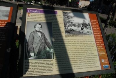
Strategically located south of Denver, Douglas County welcomed fortune seekers headed to the capital city. But some newcomers decided to stay in the county and develop farms, ranches, and small businesses. In 1874, due to an increase in population, legislators compressed Douglas County to it present 843 square miles. It became known for its small, friendly towns and prosperous ranch spreads. In the late twentieth century, tens of thousands of people who appreciated the county’s relaxed lifestyle moved to new communities such as Highland Ranch and Lone Tree and mushrooming suburbs near Parker and Castle Rock. Since the 1990s, Douglas County has been one of the fastest growing counties in the nation with booming retail development, job growth, and strong school districts. But residents, many of them recent arrivals, criticized the detrimental effects of growth on the environment. In the 1990s residents formed the Douglas County
Historic Preservation Board and Douglas County open lands Coalition to preserve the cultural and natural resources of the county and steer future growth according to community visions and goals.
Captions:
Colorado territorial representatives named Douglas County for Democratic U.S. Senator Stephen A. Douglas from Illinois, the “Little Giant” who had died of typhoid fever just after the start of the Civil War. As chairman of the Senate Committee on Territories, Douglas believed fervently in the expansion of the United States, the Unionist cause, and “popular sovereignty,” self-government for the territories and state governments. Colorado was a Republican territory, but the local politicians respected Douglas and named a strategically placed county after him.
During the 1890s, when Charles Hincke made this photograph at a spot near Parker, much of Douglas County was ranch land. Photo courtesy Colorado Historical Society.
“You cannot stop any group of people anywhere if they put their passion into something. All the lawyers and all the government in the world cannot stop people from caring if they’re willing to commit their time to it.”
Micki Clark, Douglas County Open lands Coalition.
Erected by Colorado Historical Society.
Topics. This historical marker is listed in these topic
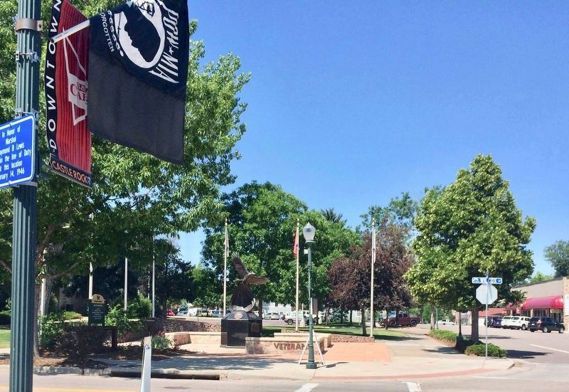
Location. Marker is missing. It was located near 39° 22.391′ N, 104° 51.608′ W. Marker was in Castle Rock, Colorado, in Douglas County. Marker was at the intersection of Wilcox Street and 4th Street NE, on the right when traveling south on Wilcox Street. Touch for map. Marker was in this post office area: Castle Rock CO 80104, United States of America. Touch for directions.
Other nearby markers. At least 8 other markers are within 3 miles of this location, measured as the crow flies. Keystone Hotel (within shouting distance of this marker); Good Roads in Colorado / The Great North-South Highway (about 300 feet away, measured in a direct line); The Rock / Gray Gold (about 300 feet away); City Hotel (about 500 feet away); Victoria’s House (about 500 feet away); Denver & Rio Grande Railroad Depot (about 700 feet away); Rock Park (approx. 0.6 miles away); Founders Village (approx. 2˝ miles away). Touch for a list and map of all markers in Castle Rock.
Credits. This page was last revised on July 6, 2017. It was originally submitted on August 14, 2011, by Charles T. Harrell of Woodford, Virginia. This page has been viewed 870 times since then and 23 times this year. Photos: 1. submitted on August 14, 2011, by Charles T. Harrell of Woodford, Virginia. 2. submitted on July 1, 2017, by Mark Hilton of Montgomery, Alabama. • Bill Pfingsten was the editor who published this page.

