Scranton in Lackawanna County, Pennsylvania — The American Northeast (Mid-Atlantic)
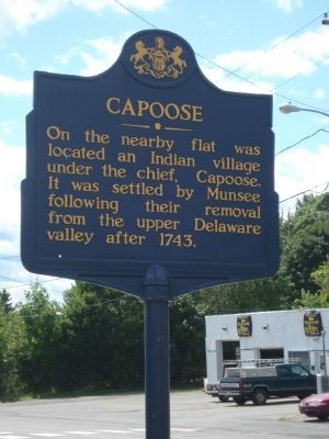
Capoose
Erected by Pennsylvania Historical and Museum Commission.
Topics and series. This historical marker is listed in this topic list: Native Americans. In addition, it is included in the Pennsylvania Historical and Museum Commission series list. A significant historical year for this entry is 1743.
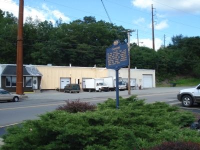
Location. 41° 25.529′ N, 75° 39.975′ W. Marker is in Scranton, Pennsylvania, in Lackawanna County. Marker is at the intersection of Providence Road and Diamond Avenue, on the right when traveling north on Providence Road. Touch for map. Marker is in this post office area: Scranton PA 18508, United States of America. Touch for directions.
Other nearby markers. At least 8 other markers are within walking distance of this marker. Miners and Laborers Memorial (here, next to this marker); Reddington Field (about 400 feet away, measured in a direct line); Weston Field and Field House (about 500 feet away); The Tripp House (approx. 0.2 miles away); a different marker also named The Tripp House (approx. 0.2 miles away); The Electric City (approx. 0.4 miles away); Munsee Indian Village (approx. 0.4 miles away); Lackawanna River Watershed History (approx. 0.4 miles away). Touch for a list and map of all markers in Scranton.
Credits. This page was last revised on June 16, 2016. It was originally submitted on August 24, 2011. This page has been viewed 1,340 times since then and 99 times this year. Photos: 1, 2. submitted on August 24, 2011. • Bill Pfingsten was the editor who published this page.

