Perryville in Boyle County, Kentucky — The American South (East South Central)
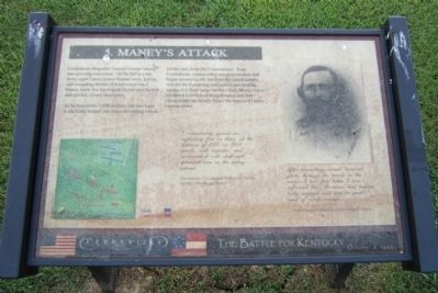
Maney's Attack
Perryville • The Battle For Kentucky
— October 8, 1862 —
As he formed his 1,600 soldiers into two lines in the fields behind you, trees and rolling terrain hid his men from the Union battery. Four Confederate cannon rolled into position here and began answering the fire from the Union battery. Amidst the thundering concussion and swirling smoke of a close-range artillery duel, Maney’s men advanced to within striking distance and then charged into the deadly fire of the surprised Union cannon crews.
I immediately opened an enfilading fire on them, at the distance of 250 or 300 yards, with canister, and continued it with shell and spherical case as the enemy retired.
Confederate 1st Lieutenant William B. Turner
Turner’s Mississippi Battery
After proceeding several hundred yards through the woods in the course I had first taken I was informed Gen. Donelson had become hotly engaged and was in great need of reinforcements.
Confederate Brigadier General George E. Maney
Topics. This historical marker is listed in this topic list: War, US Civil.
Location. 37° 40.71′ N, 84° 58.198′ W. Marker is in Perryville, Kentucky, in Boyle County. Marker can be reached from Park Road west of Battlefield Road (Route 1920). Located in Perryville Battlefield State Historic Site. Touch for map. Marker is at or near this postal address: 1825 Battlefield Road, Perryville KY 40468, United States of America. Touch for directions.
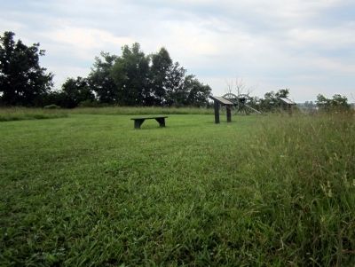
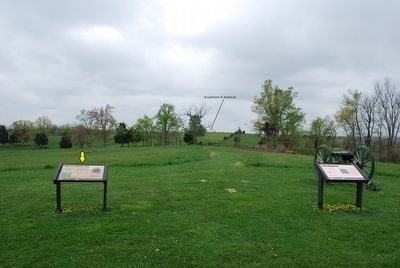
Other nearby markers. At least 8 other markers are within walking distance of this marker. Turner's Battery (here, next to this marker); Assault on Parsons’ Ridge (about 600 feet away, measured in a direct line); Stewart's Advance (about 700 feet away); Army of the Mississippi (about 800 feet away); Defense of Parsons’ Ridge (approx. 0.2 miles away); On this Spot Brig. Gen. James S. Jackson Fell (approx. 0.2 miles away); a different marker also named Defense of Parsons’ Ridge (approx. 0.2 miles away); Army of the Ohio (approx. ¼ mile away). Touch for a list and map of all markers in Perryville.
More about this marker. On the upper right is a photograph of Confederate Brigadier General George E. Maney. United States Military History Institute, Carlisle, Pennsylvania
Credits. This page was last revised on April 29, 2021. It was originally submitted on August 25, 2011, by Bernard Fisher of Richmond, Virginia. This page has been viewed 892 times since then and 37 times this year. Photos: 1, 2. submitted on August 25, 2011, by Bernard Fisher of Richmond, Virginia. 3. submitted on September 14, 2015, by Brandon Fletcher of Chattanooga, Tennessee.


