
Liberty in Clay County, Missouri — The American Midwest (Upper Plains)
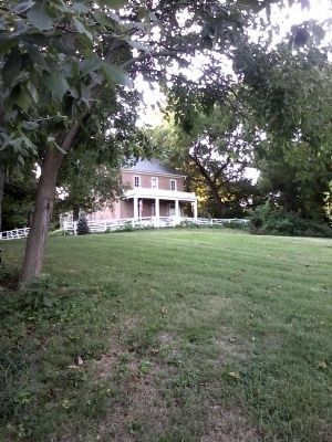
Riverview
Clay County Historical Society
| — | Historic Landmark | — |
Photographed by Tony Meyers, August 25, 2011
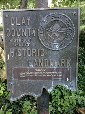
1. Riverview Marker
Riverview - Clay County Historic Landmark
Erected by Clay County Missouri Historical Society.
Topics. This historical marker is listed in these topic lists: Architecture • Landmarks. A significant historical year for this entry is 1849.
Location. 39° 15.328′ N, 94° 25.356′ W. Marker is in Liberty, Missouri, in Clay County. It is at the intersection of Crawford Lane and North Grover Street on Crawford Lane. Touch for map. Marker is in this post office area: Liberty MO 64068, United States of America. Touch for directions.

Regionally, this marker is in the Missouri River Corridor and in Greater Kansas City. It is also in the American Midwest, in the Lewis & Clark Corridor, and in the Corn Belt. Globally, it is in North America, the Western Hemisphere, the Western World, and the Anglosphere. Historically, it finds itself in what was once the territory of the Mississippian Culture, the Louisiana Purchase, and the Antebellum South.
this page online
Other nearby markers. At least 8 other markers are within walking distance of this marker: Garrison School (approx. ¼ mile away); St. Luke A.M.E. Church (approx. 0.3 miles away); In Memory of Betty Lou & Denny Anderson (approx. 0.4 miles away); Liberty Juneteenth (approx. 0.4 miles away); Ruth Powell Moore (approx. 0.4 miles away); The Liberty, Missouri Juneteenth Legacy (approx. 0.4 miles away); William Lawrence Smith (approx. 0.4 miles away); Meals On Wheels (approx. 0.4 miles away). Touch for a list and map of all markers in Liberty.
More about this marker. Marker is located near and visible from the road. Look northwest from the intersection of Crawford Lane and North Grover Street.
Additional keywords. Liberty Missouri
Photographed by Tony Meyers, August 25, 2011
2. Riverview - Liberty, Missouri
Credits. This page was last revised on December 16, 2020. It was originally submitted on August 27, 2011, by Tony Meyers of Liberty, Missouri. This page has been viewed 975 times since then and 22 times this year. Photos: 1, 2. submitted on August 27, 2011, by Tony Meyers of Liberty, Missouri. • Bill Pfingsten was the editor who published this page.
