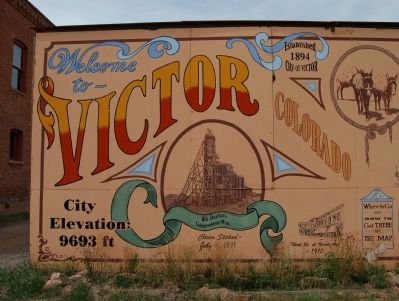
Welcome to Victor Colorado
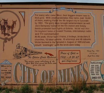
City of Mines
| — | City Elevation: 9693 ft | — |
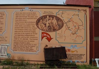
Gold was discovered by Bob Womack near Cripple Creek in 1890 and through the years, over 500 mines have employed more than 6000 miners.
The Cresson Mine produced 60,000 ounces of gold from a room-sized, crystalline “vug” located 1200’ below the surface. The Portland II Mine was 3500’ deep and the American Eagles was one of the highest at 10,750’. The legendary Independence Mine was sold by W. S. Stratton in 1899 for 11,000,000. The district has produced over 22 million ounces of gold to date. In 1994 Victor
this page online
Victor Historic Preservation Commission
The Cripple Creek & Victor Cold Mining Co.
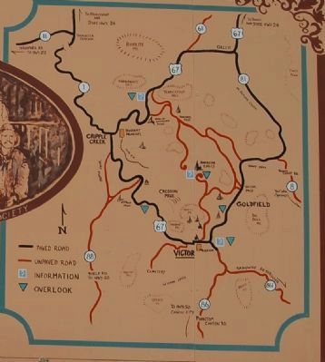
[Captions: Established 1894; W.S. Stratton’s Independence Mine, Claim Staked July 4, 1891; Third St. at Victor Ave., c. 1912; Where to Go and How to Get There, See the Map; The Golden Circle Railroad. This narrow gauge subsidiary of the Gold Belt Line served the Victory area from 1896-1912; Price of Gold in 1900 – 20.67 per troy ounce; Daily Pay – 1900, $3.00 per eight hour shift; Machine Drilling 1000 ft Underground; 1 Ton Cart]
Victor Chamber of Commerce
Byron Signs – Colorado Springs
Many Wonderful Volunteers!
Erected by Victor Historic Preservaton Commission.
Topics. This historical marker is listed in these topic lists: Industry & Commerce • Natural Resources. A significant historical date for this entry is July 4, 1895.
Location. 38° 42.629′ N, 105° 8.53′ W. Marker is in Victor, Colorado, in Teller County. It is on Victor Avenue. Touch for map. Marker is at or near this postal

Regionally, this marker is in the Colorado High Rockies and in Pikes Peak Region. It is also in the American Mountain West. Globally, it is in North America, the Rocky Mountains, the Western Hemisphere, the Western World, and the Anglosphere.
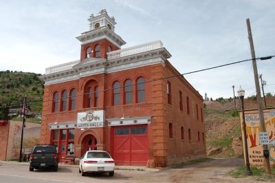
Other nearby markers. At least 8 other markers are within walking distance of this marker: Victor City Hall (a few steps from this marker); Labor Wars (within shouting distance of this marker); North 4th Street (about 300 feet away, measured in a direct line); The Bawdy Side of Town (about 600 feet away); Lowell Thomas’s Victor (about 600 feet away); Fire! (about 600 feet away); North 3rd Street (about 600 feet away); East Victor Avenue (about 800 feet away). Touch for a list and map of all markers in Victor.
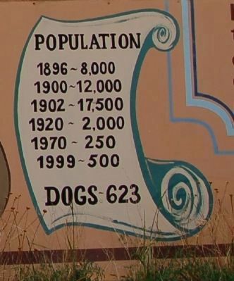
More about this marker. This marker is a big as a billboard and longer too. It could not be captured in one image so it had been photographed in three parts.
Also see . . . Victor Colorado - Wikipedia. (Submitted on September 1, 2011, by Barry Swackhamer of Brentwood, California.)
Additional keywords. Colorado
Credits. This page was last revised on June 16, 2016. It was originally submitted on September 1, 2011, by Barry Swackhamer of Brentwood, California. This page has been viewed 1,583 times since then and 65 times this year. Photos: 1, 2, 3, 4, 5, 6, 7. submitted on September 1, 2011, by Barry Swackhamer of Brentwood, California. • Bill Pfingsten was the editor who published this page.
