Mesquite in Clark County, Nevada — The American Mountains (Southwest)
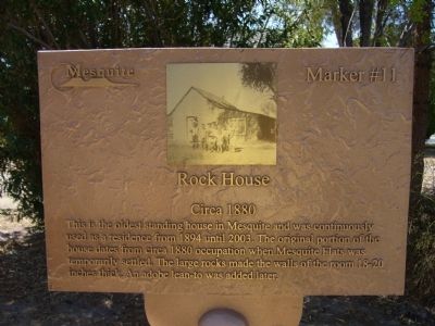
Rock House
Circa 1880
Photographed by Bill Kirchner, August 29, 2011
1. Rock House Marker
Erected by City of Mesquite. (Marker Number 11.)
Topics. This historical marker is listed in these topic lists: Architecture • Settlements & Settlers. A significant historical year for this entry is 1894.
Location. 36° 48.315′ N, 114° 3.962′ W. Marker is in Mesquite, Nevada, in Clark County. It is on East 1st North, on the right when traveling east. Touch for map. Marker is at or near this postal address: 110 East 1st North, Mesquite NV 89027, United States of America. Touch for directions.

Regionally, this marker is in the Mojave Desert and in Greater Las Vegas. It is also in the American Southwest and in the Mountain West. Globally, it is in North America, the Western Hemisphere, the Western World, and the Anglosphere. Historically, it finds itself in what was once New Spain and also
this page online
Other nearby markers. At least 8 other markers are within walking distance of this marker: John David Pulsipher Home (within shouting distance of this marker); Charles Hardy Home (within shouting distance of this marker); School and Gymnasium Block (about 300 feet away, measured in a direct line); Drug Store / Bakery (about 400 feet away); Tithing Lot (about 500 feet away); Abram Woodbury Home and Gas Station (about 500 feet away); History of Mesquite (about 500 feet away); William Elias Abbott (about 600 feet away). Touch for a list and map of all markers in Mesquite.
Photographed by Bill Kirchner, August 29, 2011
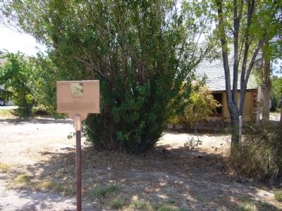
2. Rock House Marker
Photographed by Bill Kirchner, August 29, 2011
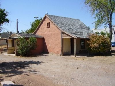
3. Rock House
Photographed by Bill Kirchner
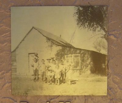
4. Close-Up of Photo Displayed on Marker
Credits. This page was last revised on December 20, 2020. It was originally submitted on September 1, 2011, by Bill Kirchner of Tucson, Arizona. This page has been viewed 1,769 times since then and 116 times this year. Photos: 1, 2, 3, 4. submitted on September 1, 2011, by Bill Kirchner of Tucson, Arizona. • Syd Whittle was the editor who published this page.
