Henrico in Henrico County, Virginia — The American South (Mid-Atlantic)
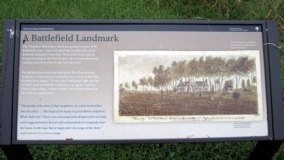
A Battlefield Landmark
The Binford farm stretched behind the West House to the southeast. Union reserves crammed every corner of the field, awaiting their chance. “It was a great and grand sight, the like of which in all probability I shall never see again,” wrote a Third Corps soldier. “Lines of Battle were formed almost as far as the eye could reach.”
“The family, with some of their neighbors, in consternation fled into the cellar….The head of the house in great distress enquired, ‘What shall I do?’ There was a dressing-table draped with red cloth, and I suggested that it be torn off and fastened on a long pole over the house, in the hope that it might alter the range of the shots.”
Chaplain Edward D. Neill, 1st Minnesota Infantry
Erected 2011 by Richmond National Battlefield Park.
Topics. This historical marker is listed in this topic list: War, US Civil. A significant historical month for this entry is July 1864.
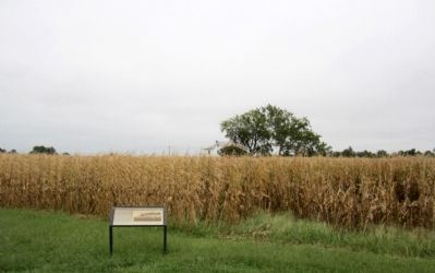
Location. 37° 24.815′ N, 77° 14.908′ W. Marker is in Henrico, Virginia, in Henrico County. Marker can be reached from Willis Church Road (Virginia Route 156) 0.2 miles north of Carters Mill Road (County Road 606), on the right when traveling north. Marker is located in the Malvern Hill Unit of Richmond National Battlefield Park. Touch for map. Marker is at or near this postal address: 9175 Willis Church Road, Henrico VA 23231, United States of America. Touch for directions.
Other nearby markers. At least 8 other markers are within walking distance of this marker. The West House (within shouting distance of this marker); The Battle of Malvern Hill (within shouting distance of this marker); Artillery’s Terrible Effect (within shouting distance of this marker); Seven Days Battles (within shouting distance of this marker); Battlefield of Malvern Hill (about 300 feet away, measured in a direct line); Battlefield Landscape (about 400 feet away); a different marker also named Seven Days Battles (about 500 feet away); Southern Valor vs. Union Firepower (about 500 feet away). Touch for a list and map of all markers in Henrico.
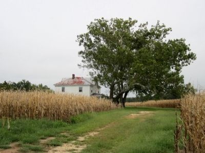
More about this marker. On the right is a "Sketch by Union mapmaker, Private Robert K. Sneden." Virginia Historical Society It carries the caption, "The current house was built in the 1900s atop the foundation of the wartime West house."
Also see . . .
1. The Battle of Malvern Hill. Richmond National Battlefield Park (Submitted on September 7, 2011, by Bernard Fisher of Richmond, Virginia.)
2. Malvern Hill. Civil War Trust (Submitted on September 7, 2011, by Bernard Fisher of Richmond, Virginia.)
Credits. This page was last revised on June 16, 2016. It was originally submitted on September 7, 2011, by Bernard Fisher of Richmond, Virginia. This page has been viewed 624 times since then and 16 times this year. Photos: 1, 2, 3. submitted on September 7, 2011, by Bernard Fisher of Richmond, Virginia.


