Governors Island in Manhattan in New York County, New York — The American Northeast (Mid-Atlantic)
The Buttermilk Channel and Brooklyn Waterfront
Governors Island
Inscription.
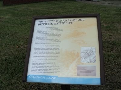
This view looks over the Buttermilk Channel to the Brooklyn waterfront, located only 400 yards away. Many theories surround the naming of this narrow waterway. In years past, the channel was much wider and shallower than it is today – before the piers and the dredging of the channel gave it its current appearance. The waters in this channel were rough and fast, leading to two theories: one, that the appearance of the white water looked like buttermilk; and two, that the fast rough action of the water was actually used to help churn Brooklyn farmers’ milk. Another theory was that cattle actually crossed the channel to graze on Governors Island. Walt Whitman wrote, “as late as the Revolutionary War cattle were driven across from Brooklyn, over what is now Buttermilk Channel, to Governors Island.”
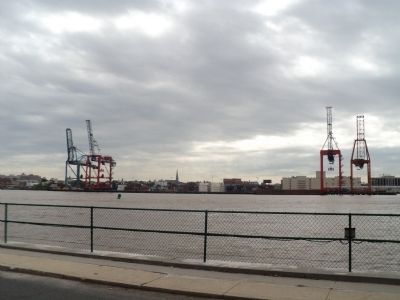
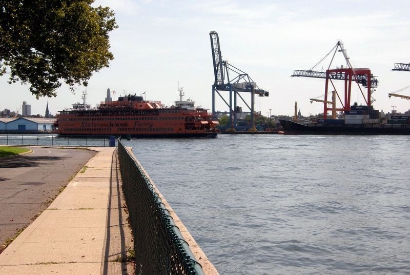
Across the channel, the Brooklyn waterfront was one of the busiest waterfronts in the nation. The introduction of the steamship in 1815 and the opening of the Erie Canal in 1825 meant that the demand for waterfront space was high. Land in Brooklyn was cheaper and more spacious than lower Manhattan and the shipping industry exploded in this area Activity along the waterfront declined in the 1950s when shipping shifted to container systems and less manpower was needed. Though much of the container shipping industry moved to New Jersey, you can still see a functioning shipping industry across the channel.
Along the waterfront to the right, you can see the Atlantic Basin, where a cutting-edge shipyard was built in 1840, with a 200 foot opening and room for 150 ships to be protected on all sides – a unique design at the time. The basin remains today with the terminal for the Queen Mary II and other cruise ships at its southern end. Today, a long swath of the waterfront south of the Brooklyn Bridge will be the site of the new Brooklyn Bridge Park.
Topics. This historical marker is listed in this topic list: Waterways & Vessels. A significant historical year for this entry is 1815.
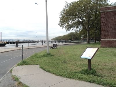
Location. 40° 41.242′ N, 74° 0.892′ W. Marker is in Manhattan, New York, in New York County. It is on Governors Island. Marker is at the intersection of Kimmel Road and Comfort Road, on the right when traveling south on Kimmel Road. Marker is located on the eastern end of Governors Island. Touch for map. Marker is in this post office area: New York NY 10004, United States of America. Touch for directions.
Other nearby markers. At least 8 other markers are within walking distance of this marker. Oysters in the Harbor: A History (within shouting distance of this marker); Middens and Reefs (within shouting distance of this marker); The South Battery (about 300 feet away, measured in a direct line); a different marker also named The South Battery (about 300 feet away); St. Cornelius Chapel (about 300 feet away); John Peter Zenger (about 300 feet away); Maj. General Hanson E. Ely Retirement (about 300 feet away); Tower Carillon Chimes (about 400 feet away). Touch for a list and map of all markers in Manhattan.
More about this marker. The background of the marker features an aerial picture of New York Harbor. Below this are a map and a photo of Governors Island.
Also see . . . Governors Island National Monument. National Park Service website. (Submitted on September 12, 2011, by Bill Coughlin of Woodland Park, New Jersey.)
Credits. This page was last revised on January 31, 2023. It was originally submitted on September 12, 2011, by Bill Coughlin of Woodland Park, New Jersey. This page has been viewed 555 times since then and 18 times this year. Photos: 1, 2, 3. submitted on September 12, 2011, by Bill Coughlin of Woodland Park, New Jersey. 4. submitted on April 5, 2020, by Larry Gertner of New York, New York.


