
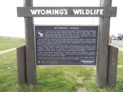
Wyoming Winds
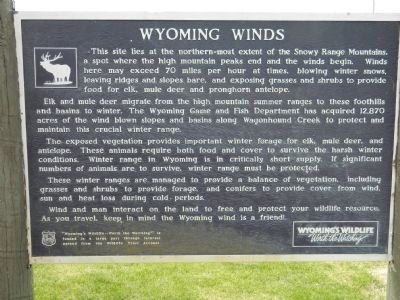
Elk and mule deer migrate from the high mountain summer ranges to these foothills and basins to winter. The Wyoming game and Fish Department has acquired 12,870 acres of the wind blown slopes and basins along Wagonhound Creek to protect and maintain this crucial winter range.
The exposed vegetation provides important winter forage for elk, mule deer, and antelope. These animals require both food and cover to survive the harsh winter conditions. Winter range in Wyoming is in critically short supply. If significant numbers of animals are to survive, winter range must be protected.
These winter ranges are managed to provide a balance of vegetation, including grasses and shrubs to provide forage, and conifers to provide cover from wind, sun and heat loss during cold periods.
Wind and man interact on the
this page online
Erected by Wyoming's Wildlife - Worth the Watching.
Topics. This historical marker is listed in these topic lists: Animals • Environment • Natural Resources.
Location. 41° 37.861′ N, 106° 17.146′ W. Marker is in Elk Mountain, Wyoming, in Carbon County. It is at the intersection of Interstate 80 and Elk Mountain Arlington Road on Interstate 80. Marker is in rest area off I80. Touch for map. Marker is in this post office area: Elk Mountain WY 82324, United States of America. Touch for directions.

Regionally, this marker is in Wyoming’s Westward Expansion Trails Region. It is also in the American Mountain West. Globally, it is in North America, the Rocky Mountains, the Western Hemisphere, the Western World, and the Anglosphere. Historically, it finds itself in what was once the Republic of Texas.
Other nearby markers. At least 5 other markers are within 8 miles of this marker, measured as the crow flies: Wagonhound Rest Area (here, next to this marker);
Credits. This page was last revised on June 16, 2016. It was originally submitted on September 14, 2011, by Bill Pfingsten of Bel Air, Maryland. This page has been viewed 1,045 times since then and 56 times this year. Photos: 1, 2. submitted on September 14, 2011, by Bill Pfingsten of Bel Air, Maryland.
