
Wagonhound Tipi Rings
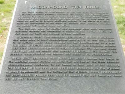
The tipi was used for shelter and sleeping. Most daily activities occurred outside the structure. A hearth in the center of the tipi was used for heat and cooking in poor weather.
In prehorse times, tipis averaged approximately 12 feet in diameter and poles used in their construction were up to 15 feet long. Eight to 12 buffalo hides were needed for the construction of a tipi. The hides of buffalo killed during the summer were preferred because they were thinner and lighter in weight. A smudge fire was built inside a new tipi, and the smoke was allowed to permeate the leather. This process waterproofed the leather and aided in its preservation.
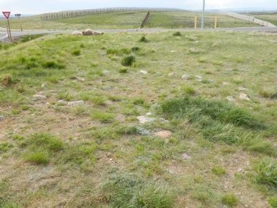
It has been estimated that there are over 1 million tipi rings in the western United States. As such, they are one of the most common archaeological features to be found in this part of the country. The features at this area have been preserved by the Wyoming Highway Department and the Office of the Wyoming State Archaeologist for your benefit. Please feel free to inspect the tipi rings up close, but do not disturb the rocks.
Topics.
this page online
Location. 41° 37.883′ N, 106° 17.152′ W. Marker is in Elk Mountain, Wyoming, in Carbon County. It can be reached from the intersection of Interstate 80 and Elk Mountain Arlington Road. Marker is in the I80 rest area. Touch for map. Marker is in this post office area: Elk Mountain WY 82324, United States of America. Touch for directions.

Regionally, this marker is in Wyoming’s Westward Expansion Trails Region. It is also in the American Mountain West. Globally, it is in North America, the Rocky Mountains, the Western Hemisphere, the Western World, and the Anglosphere. Historically, it finds itself in what was once the Republic of Texas.
Other nearby markers. At least 5 other markers are within 8 miles of this marker, measured as the crow flies: Wyoming Winds (within shouting distance of this marker); Wagonhound Rest Area (within shouting distance of this marker); Old Cherokee Trail (approx. one mile away); Old Rock Creek Stage Crossing (approx. 4.7 miles away); Overland Trail (approx.
Credits. This page was last revised on June 16, 2016. It was originally submitted on September 14, 2011, by Bill Pfingsten of Bel Air, Maryland. This page has been viewed 2,296 times since then and 169 times this year. Photos: 1, 2. submitted on September 14, 2011, by Bill Pfingsten of Bel Air, Maryland.
