Paducah in McCracken County, Kentucky — The American South (East South Central)
Raymond C. Schultz Park
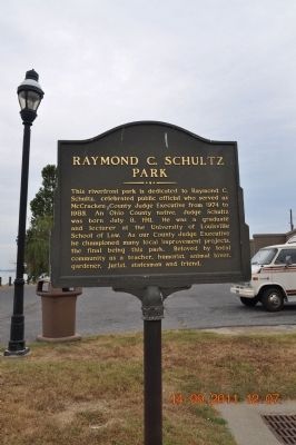
Photographed by Sandra Hughes, September 14, 2011
1. Raymond C. Schultz Park Marker
Topics. This historical marker is listed in these topic lists: Charity & Public Work • Government & Politics. A significant historical month for this entry is July 1791.
Location. 37° 5.425′ N, 88° 35.766′ W. Marker is in Paducah, Kentucky, in McCracken County. It is on N. 2nd Street close to Monroe Street. Paducah Riverfront In Raymond Schultz Park on the Ohio River behind the Mural Walls. Touch for map. Marker is in this post office area: Paducah KY 42001, United States of America. Touch for directions.

Regionally, this marker is in the Jackson Purchase. It is also in the American Midwest, in the South, in the Upper South, and in the Ohio River Valley. Globally, it is in North America, the Western Hemisphere, the Western World, and the Anglosphere. Historically, it finds itself in what was once the territory of the Mississippian Culture and also the Antebellum South.
Other nearby markers. At least 8 other markers are within walking distance of this marker: Tennessee ~Tombigbee Waterway (here, next to this marker); Lewis and Clark in Kentucky McCracken County / McCracken County (about 500 feet away, measured in a direct line); Flanking the Statue of Chief Paduke (about 600 feet away); On the Trail of Discovery (about 600 feet away); The Telephone System (about 600 feet away); Broadway, Paducah's Main Street
this page online
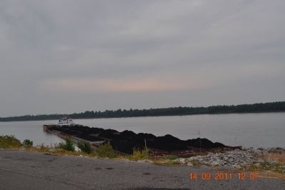
Photographed by Sandra Hughes, September 14, 2011
2. Raymond C. Schultz Park / Ohio River
Credits. This page was last revised on June 16, 2016. It was originally submitted on September 16, 2011, by Sandra Hughes Tidwell of Killen, Alabama, USA. This page has been viewed 945 times since then and 48 times this year. Photos: 1, 2. submitted on September 16, 2011, by Sandra Hughes Tidwell of Killen, Alabama, USA. • Bill Pfingsten was the editor who published this page.
