St. Joseph in Buchanan County, Missouri — The American Midwest (Upper Plains)
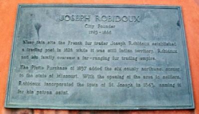
Joseph Robidoux
City Founder
— 1783 - 1868 —
Near this site the French fur trader Joseph Robidoux established a trading post in 1826 while it was still Indian territory. Robidoux and his family oversaw a far-ranging fur trading empire.
The Platte Purchase of 1837 added the six county northwest corner to the state of Missouri. With the opening of the area to settlers, Robidoux incorporated the town of St. Joseph in 1843, naming it for his patron saint.
Topics. This historical marker is listed in these topic lists: Exploration • Government & Politics • Native Americans • Settlements & Settlers. A significant historical year for this entry is 1826.
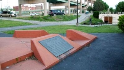
Location. 39° 45.979′ N, 94° 51.652′ W. Marker is in St. Joseph, Missouri, in Buchanan County. Marker is in the Missouri riverfront park, accessed via Francis Street, and about 200 yards southwest of the I-229 Exit 6A ramps. Touch for map. Marker is in this post office area: Saint Joseph MO 64501, United States of America. Touch for directions.
Other nearby markers. At least 8 other markers are within walking distance of this marker. Pony Express (here, next to this marker); The California - Oregon Trail (here, next to this marker); St. Michael's Prairie / The Lewis and Clark Expedition (here, next to this marker); a different marker also named Pony Express (approx. 0.2 miles away); The Journey West (approx. ¼ mile away); Missouri Valley Trust Company (approx. 0.3 miles away); The Boder Building (approx. 0.3 miles away); Buchanan County Courthouse (approx. 0.4 miles away). Touch for a list and map of all markers in St. Joseph.
Related markers. Click here for a list of markers that are related to this marker.
Also see . . .
1. Joseph Robidoux. St. Joseph Missouri website entry (Submitted on September 22, 2011, by William Fischer, Jr. of Scranton, Pennsylvania.)
2. Joseph Robidoux family papers. State Historical Society of Missouri website PDF (Submitted on September 22, 2011, by William Fischer, Jr. of Scranton, Pennsylvania.)
Credits. This page was last revised on April 25, 2022. It was originally submitted on September 22, 2011, by William Fischer, Jr. of Scranton, Pennsylvania. This page has been viewed 759 times since then and 28 times this year. Photos: 1, 2. submitted on September 22, 2011, by William Fischer, Jr. of Scranton, Pennsylvania.

