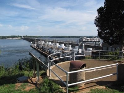
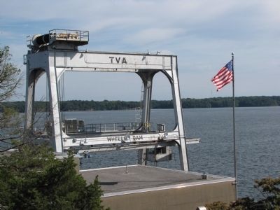
Near Town Creek in Lawrence County, Alabama — The American South (East South Central)
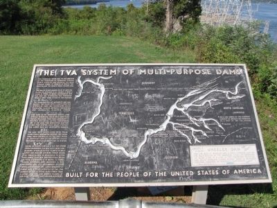
The TVA System of Multi-purpose Dams
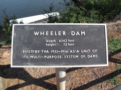
Wheeler Dam
— Built for the people of the United States of America —
The Tennessee River has its headwaters in the mountains of Tennessee, Virginia, North Carolina and Georgia. The main stream forms at Knoxville, where the Houston and the French Broad Rivers join.
The valley, 41,000 square miles in area, receives an average of 52 inches of rain a year. In terms of water discharged into the Ohio and Mississippi, the Tennessee River is about equal in size to the Missouri.
The Tennessee Valley Authority has harnessed the river with a multi-purpose system of dams and reservoirs which regulates floods, improves navigation, and generates electric power.
High dams on the tributaries create large storage reservoirs which hold back flood waters, releasing them when necessary to maintain navigation depths downstream, and at the same time generating electric power. The system also helps protect the lower Ohio and Mississippi Valleys.
The nine main river dams, with their locks, form a navigable channel 650 miles long, from Knoxville to the Ohio River, an important arm of the nation's inland waterway system connecting 20 states.
Having developed virtually all the river power resources, TVA has built huge coal-burning steam electric plants to help serve the region's growing power needs. TVA power is sold at wholesale to cities and rural electric cooperatives which, in turn, distribute it at retail to homes, farms, business and industry. A few industries and U.S. Government Defense installations that use large amounts of power are served directly by TVA. The largest of these, using more power than a great city, are the atomic plants at Oak Ridge, Tennessee, and Paducah, Kentucky.
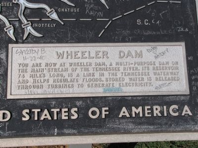
WHEELER DAM
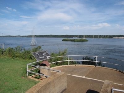
You are now at Wheeler Dam, a multi-purpose dam on the main stream of the Tennessee River. Its reservoir 74 miles long, is a link in the Tennessee Waterway and helps regulate floods. Stored water is released through turbines to generate electricity.
Erected by Tennessee Valley Authority.
Topics. This historical marker is listed in these topic lists: Charity & Public Work • Industry & Commerce • Waterways & Vessels.
Location. 34° 47.783′ N, 87° 22.917′ W. Marker is near Town Creek, Alabama, in Lawrence County. Marker can be reached from Wheeler Dam Rd (State Highway 101) north of County Road 150, on the right when traveling north. Marker is located near the visitor center parking lot at the base of the stairs leading to the power house. Touch for map. Marker is in this post office area: Town Creek AL 35672, United States of America. Touch for directions.
Other nearby markers. At least 8 other markers are within 4 miles of this marker, measured as the crow flies. A Brief History (approx. ¼ mile away); From Wheeler to the moon ... (approx. ¼ mile away); Wheeler Dam • Wheeler Reservoir/Locks (approx. 1.3 miles away); General Joseph Wheeler (approx. 3.1 miles away); Trail of Tears (approx. 3.1 miles away); Covington/Second Creek / Wheeler Dam/Lake (approx. 3.3 miles away); Bettie Anne Highway (approx. 3.7 miles away); Elgin/Elgin Crossroads (approx. 3.8 miles away). Touch for a list and map of all markers in Town Creek.
Related markers. Click here for a list of markers that are related to this marker. To better understand the relationship, study each marker in the order shown.
Credits. This page was last revised on August 16, 2020. It was originally submitted on September 23, 2011, by Lee Hattabaugh of Capshaw, Alabama. This page has been viewed 1,037 times since then and 32 times this year. Photos: 1, 2, 3, 4, 5, 6, 7. submitted on September 23, 2011, by Lee Hattabaugh of Capshaw, Alabama. • Bill Pfingsten was the editor who published this page.
