Tell City in Perry County, Indiana — The American Midwest (Great Lakes)
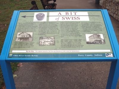
A Bit of Swiss
Photographed by Courtesy:: Marilyn S. Wolf, September 18, 2011
1. A Bit of Swiss Marker
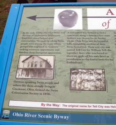
German-speaking Swiss people and others like them already living in Cincinnati, Ohio, formed the Swiss Colonization Society in 1856.
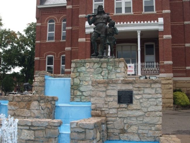
A committee was formed to find a new home along a river in a free state. Indiana was chosen for its border on the Ohio River and its beautiful hills resembling sections of their Swiss homeland. Their new city was named Tell City for William Tell, the legendary hero who was forced to shoot an apple off his son’s head as punishment to the feudal lords for his disobedience.
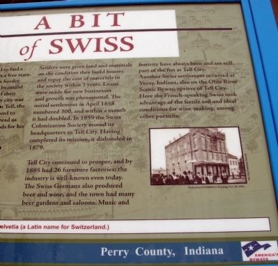
Settlers were given land and materials on the condition they build houses and repay the cost of materials to the society within 3 years. Loans were made for new businesses and growth was phenomenal. The initial settlement in April 1858 numbered 300, and within a month it had doubled. In 1859 the Swiss Colonization Society moved its headquarters to
this page online
Tell City continued to prosper, and by 1885 had 26 furniture factories; the industry is well-known even today. The Swiss Germans also produced beer and wine, and the town had many beer gardens and saloons. Music and festivity have always been and are still part of the fun at Tell City.
Another Swiss settlement occurred at Vevay, Indiana, also on the Ohio River Scenic Byway, upriver of Tell City. Here the French-speaking Swiss took advantage of the fertile soil and ideal conditions for wine-making, among other pursuits.
By the Way: The original name for Tell City was Helvetia (a Latin name for Switzerland.)
Topics. This historical marker is listed in this topic list: Notable Places. A significant historical month for this entry is April 1858.
Location. 37° 57.095′ N, 86° 46.176′ W. Marker is in Tell City, Indiana, in Perry County. It is on Main Street north of Mozart Street, on the right when traveling north. For ease of parking and walking it may be best to pull off of Mozart Street into the Tell City Hall drive in getting to the marker. Located on the West lawn of the Tell
Photographed by Courtesy:: Marilyn S. Wolf, September 18, 2011
2. Left Side - - A Bit of Swiss Marker

Regionally, this marker is in the Tri-State Region and in Southern Indiana. It is also in the American Midwest, in the Ohio River Valley, and in the Corn Belt. Globally, it is in North America, the Western Hemisphere, the Western World, and the Anglosphere. Historically, it finds itself in what was once the territory of the Mississippian Culture and also the Northwest Territory.
Other nearby markers. At least 8 other markers are within 4 miles of this marker, measured as the crow flies: Tell City Hall (a few steps from this marker); Perry County Indiana Honor Roll Memorial (within shouting distance of this marker); Veterans Memorial (within shouting distance of this marker); Army and Air National Guard Veterans Memorial (within shouting distance of this marker); a different marker also named Veterans Memorial (approx. 1.2 miles away); Home of Robert C. Beauchamp / Early Plantation in County (approx. 2.8 miles away in Kentucky); a different marker also
Photographed by Courtesy:: Marilyn S. Wolf, September 18, 2011
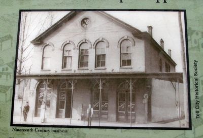
3. Marker Photo - - "Nineteenth Century Business"
Photographed by Courtesy:: Marilyn S. Wolf, September 18, 2011
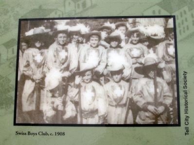
4. Marker Photo - - "Swiss Boys Club, c. 1908"
Photographed by Courtesy:: Marilyn S. Wolf, September 18, 2011
5. Right Side - - A Bit of Swiss Marker
Photographed by Courtesy:: Marilyn S. Wolf, September 18, 2011
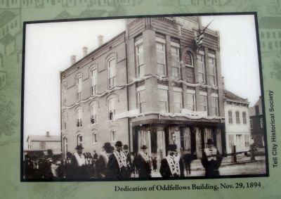
6. Marker Photo - - "Dedication of Oddfellows Building, Nov. 29, 1894"
Photographed by Courtesy:: Marilyn S. Wolf, September 18, 2011
7. "William Tell and Son" - Fountain
Photographed by Courtesy:: Marilyn S. Wolf, September 18, 2011
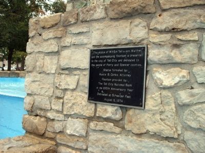
8. Fountain 1974 Dedication Plaque - - To the People of Perry & Spencer Counties.
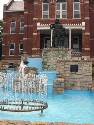
Photographed by Courtesy:: Marilyn S. Wolf, September 18, 2011
9. The Fountain ! !
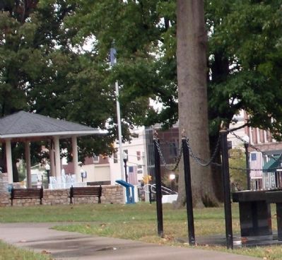
Photographed by Courtesy:: Marilyn S. Wolf, September 18, 2011
10. Wide View - - A Bit of Swiss Marker
Note marker in the lower center of this photo.

Photographed by Courtesy:: Marilyn S. Wolf, September 18, 2011
11. East Side - - Tell City Hall - - "City Park Square"
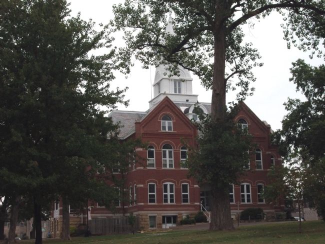
Photographed by Courtesy:: Marilyn S. Wolf, September 18, 2011
12. Tell City Hall - - "City Park Square"
Credits. This page was last revised on June 16, 2016. It was originally submitted on September 25, 2011, by Al Wolf of Veedersburg, Indiana. This page has been viewed 1,016 times since then and 37 times this year. Photos: 1, 2, 3, 4, 5, 6, 7, 8, 9, 10, 11, 12. submitted on September 25, 2011, by Al Wolf of Veedersburg, Indiana. • Bill Pfingsten was the editor who published this page.
