Bear Mountain in Rockland County, New York — The American Northeast (Mid-Atlantic)
The Historic 1777 & 1779 Trails
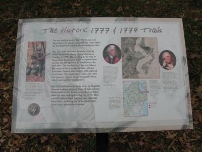
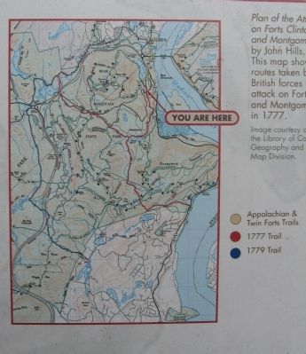
The 1777 trail represents the route taken by British General Sir Henry Clinton's forces on October 6, 1777. After landing 2,100 men at Stony Point, he marched north to capture Forts Clinton and Montgomery. At Doodletown the trail splits. The east branch of the trail follows the march of forces under Sir Henry Clinton and Major John Vaughn that captured Fort Clinton. The west branch follows the route of Lieutenant Colonel Mungo Campbell's forces which captured Fort Montgomery.
The 1779 trail traces the route taken by Brigadier General Anthony Wayne's Corps of Light Infantry in its assault on the British fortifications at Stony Point just after midnight on July 16, 1779. After a brief but fierce fight, Wayne's men captured Stony Point, achieving one of the Continental Army's most spectacular victories.
[ photo captions ]
Sir Henry Clinton by J. Stuart Rogers. To aid General Burgoyne's British army stalled at Saratoga, Sir Henry Clinton and a combined force of 3,000 soldiers sailed from New York City with a flotilla of warships. The successful destruction of Forts Montgomery and Clinton and the burning of New York's capital at Kingston delayed Clinton's men from coming to the aid of Burgoyne at Saratoga. Image courtesy of the National Army Museum, London
General Anthony Wayne by Edward Savage, 1795. Brigadier General "Mad" Anthony Wayne led the assault on the British fortifications at Stony Point just after midnight on July 16, 1779. In a bayonets-only assault lasting 30 minutes, Wayne's men overcame the British force at Stony Point. The success of this operation provided a boost to the morale of the Continental Army, and congress awarded Wayne a medal for the victory. Image courtesy of the New York Historical Society, New York City
Map of the 1777 and 1779 historic trails. Based on careful research, the modern trails follow the armies' original routes as closely as possible. The trails were cleared and blazed in time for the Bicentennial celebrations in 1976.
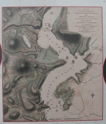
Plan of the Attack on Forts Clinton and Montgomery by John Hills, 1784. This map shows the routes taken by the British forces on their attack on Forts Clinton and Montgomery in 1777. Image courtesy of the Library of Congress, Geography and Maps Division (Marker Number 4.)
Topics. This historical marker is listed in this topic list: War, US Revolutionary. A significant historical month for this entry is July 1862.
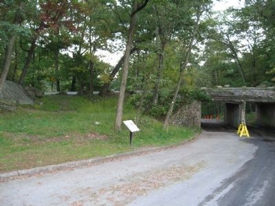
Location. 41° 18.562′ N, 73° 59.401′ W. Marker is in Bear Mountain, New York, in Rockland County. Marker can be reached from the intersection of Seven Lakes Drive and South Entrance Road, on the left when traveling west. Located on a park road next to the Seven Lakes Drive overpass, near the merry-go-round. Touch for map. Marker is in this post office area: Bear Mountain NY 10911, United States of America. Touch for directions.
Other nearby markers. At least 8 other markers are within walking distance of this marker. Discover the Appalachian National Scenic Trail (approx. ¼ mile away); Preserving a National Landmark (approx. ¼ mile away); Palisades Interstate Park (approx. ¼ mile away); First Fighting at Fort Clinton (approx. 0.4 miles away); Fighting at Hessian Lake (approx. 0.4 miles away); Walt Whitman (approx. half a mile away); Indian Campsite (approx. half a mile away); Doodletown (approx. 0.6 miles away). Touch for a list and map of all markers in Bear Mountain.
Credits. This page was last revised on June 16, 2016. It was originally submitted on October 3, 2011, by Michael Herrick of Southbury, Connecticut. This page has been viewed 1,192 times since then and 45 times this year. Photos: 1, 2, 3, 4. submitted on October 3, 2011, by Michael Herrick of Southbury, Connecticut. 5. submitted on October 9, 2011, by Michael Herrick of Southbury, Connecticut. • Bill Pfingsten was the editor who published this page.
