Streeterville in Chicago in Cook County, Illinois — The American Midwest (Great Lakes)
Terminal Building
Photographed by Barry Swackhamer, August 30, 2011
1. Terminal Building Marker
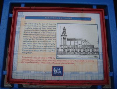
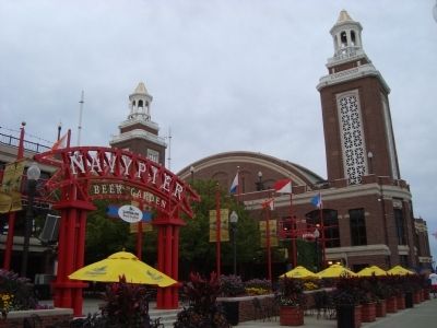
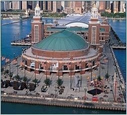
Still withstanding the test of time, the Terminal Building has hosted numerous receptions, parties and shows since it was constructed in 1916. Originally named the Terminal Building due to its function as a streetcar terminal, the structure also housed restrooms, a first-aid station, restaurant, and rooftop garden. Throughout the years, this building has served a myriad of uses... as a mess hall for sailors who trained at the Pier during World War II, and as a classroom for students attending the University of Illinois at Chicago which resided at the Pier from 1946 through 1964.
Since the Pier’s reconstruction in 1995, the Terminal Building has been utilized for meetings and exhibition space for Festival Hall. The building also houses Festival Hall’s administrative offices and catering services.
Topics. This historical marker is listed in these topic lists: Railroads & Streetcars • War, World II. A significant historical year for this entry is 1916.
Location. 41° 53.491′ N, 87° 36.034′ W. Marker is in Chicago, Illinois, in Cook County. It is in Streeterville. It can be reached from East Grand Avenue half a mile east
this page online

Regionally, this marker is on Chicago’s North Side. It is also in the American Midwest. Globally, it is in North America, on the Great Lakes, in the Western Hemisphere, in the Western World, and in the Anglosphere. Historically, it finds itself in what was once the Viceroyalty of New France, the territory of the Mississippian Culture, and the Northwest Territory.
Other nearby markers. At least 8 other markers are within walking distance of this marker: Shelter Building (within shouting distance of this marker); United States Merchant Marine (about 400 feet away, measured in a direct line); USS Chicago Anchor (about 500 feet away); a different marker also named USS Chicago Anchor (about 500 feet away); Navy Pier Salute (about 600 feet away); Reach (approx. 0.4 miles away); Storm Water Use for Irrigation (approx. half a mile away); Captain on the Helm (approx. half a mile away). Touch for a list and map
Photographed by Barry Swackhamer, August 30, 2011
2. Terminal Building Marker
Also see . . .
1. Navy Pier. Wikipedia entry (Submitted on October 4, 2011, by Barry Swackhamer of Brentwood, California.)
2. The Navy Pier. Website homepage (Submitted on October 4, 2011, by Barry Swackhamer of Brentwood, California.)
Photographed by Barry Swackhamer, August 30, 2011
3. Terminal Building
Photographed by Navypier.com
4. Terminal Building
Credits. This page was last revised on January 30, 2023. It was originally submitted on October 4, 2011, by Barry Swackhamer of Brentwood, California. This page has been viewed 2,087 times since then and 88 times this year. Photos: 1, 2, 3, 4. submitted on October 4, 2011, by Barry Swackhamer of Brentwood, California. • Bernard Fisher was the editor who published this page.
