Streeterville in Chicago in Cook County, Illinois — The American Midwest (Great Lakes)
Shelter Building
Photographed by Barry Swackhamer, August 30, 2011
1. Shelter Building Marker
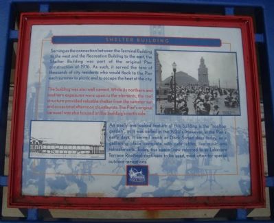
Serving as a connection between the Terminal Building to the west and the Recreation Building to the east, the Shelter Building was part of the original Pier construction of 1916. As such, it served the tens of thousands of city residents who would flock to the Pier each summer to picnic and to escape the heat of the city.
The building was also well named. While its northern and southern exposures were open to the elements, the roof structure provided valuable shelter from the summer sun and occasional afternoon cloudbursts. The Pier’s original carousel was also housed on the building’s north side.
An easily overlooked feature of this building is the “rooftop garden”, as it was called in the 1920’s. However, in the Pier’s early days, it served much as Dock Street does today, as a gathering place complete with cafe tables, live music and refreshments. Today, this space (now referred to as Lakeview Terrace Rooftop) continues to be used, most often for special outdoor receptions.
Topics. This historical marker is listed in this topic list: Entertainment. A significant historical year for this entry is 1916.
Location. 41° 53.487′ N, 87° 36.067′ W.
this page online

Regionally, this marker is on Chicago’s North Side. It is also in the American Midwest. Globally, it is in North America, on the Great Lakes, in the Western Hemisphere, in the Western World, and in the Anglosphere. Historically, it finds itself in what was once the Viceroyalty of New France, the territory of the Mississippian Culture, and the Northwest Territory.
Other nearby markers. At least 8 other markers are within walking distance of this marker: Terminal Building (within shouting distance of this marker); United States Merchant Marine (about 600 feet away, measured in a direct line); USS Chicago Anchor (about 700 feet away); a different marker also named USS Chicago Anchor (about 700 feet away); Navy Pier Salute (about 700 feet away); Reach (approx. 0.4 miles
Photographed by Barry Swackhamer, August 30, 2011
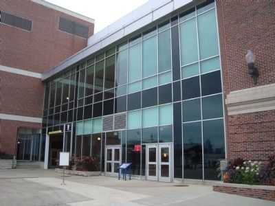
2. Shelter Building Marker
Also see . . .
1. Navy Pier. Wikipedia entry (Submitted on October 4, 2011, by Barry Swackhamer of Brentwood, California.)
2. The Navy Pier. Website homepage (Submitted on June 30, 2021, by Larry Gertner of New York, New York.)
Photographed by Barry Swackhamer, August 30, 2011
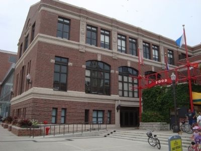
3. Shelter Building
Credits. This page was last revised on January 30, 2023. It was originally submitted on October 4, 2011, by Barry Swackhamer of Brentwood, California. This page has been viewed 650 times since then and 24 times this year. Photos: 1, 2, 3. submitted on October 4, 2011, by Barry Swackhamer of Brentwood, California. • Bernard Fisher was the editor who published this page.
