Downtown South in Las Vegas in Clark County, Nevada — The American Mountains (Southwest)
Mary Dutton Park
Gateway to the Historic John S. Park Neighborhood
Photographed by Bill Kirchner, September 26, 2011
1. Mary Dutton Park Marker
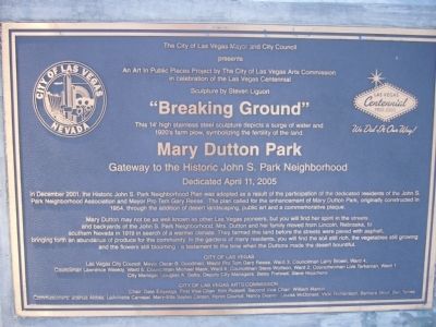
An Art in Public Places Project by The City of Las Vegas Arts Commission
In celebration of the Las Vegas Centennial
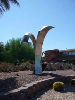
Sculpture by Steven Liguori
"Breaking Ground"
This 14' high stainless steel sculpture depicts a surge of water and
1920's farm plow, symbolizing the fertility of the land.
Mary Dutton Park
Gateway to the Historic John S. Park Neighborhood
Dedicated April 11, 2005
In December 2001, the Historic John S. Park Neighborhood Plan was adopted as a result of the participation of the dedicated residents of the John S. Park Neighborhood Association and Mayor Pro Tem Gary Reese. The plan called for the enhancement of Mary Dutton Park, originally constructed in 1954, through the addition of desert landscaping, public art and a commemorative plaque.
Mary Dutton may not be as well known as other Las Vegas pioneers, but you will find her spirit in the streets and backyards of the John S. Park Neighborhood. Mrs. Dutton and her family moved from Lincoln, Nebraska, to southern Nevada in 1919 in search of a warmer climate. They farmed this land before
this page online
Erected 2005.
Topics. This historical marker is listed in this topic list: Settlements & Settlers. A significant historical date for this entry is April 11, 1931.
Location. 36° 9.528′ N, 115° 8.599′ W. Marker
Photographed by Bill Kirchner, September 26, 2011
2. Mary Dutton Park Marker
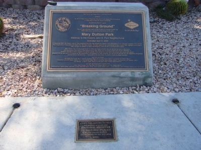
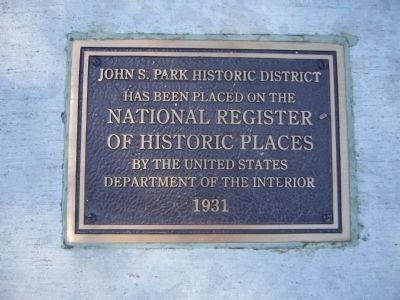
A NRHP plaque for the John S. Park Historic District is embedded in the sidewalk at the base of the Mary Dutton Park marker.

Regionally, this marker is in the Mojave Desert. It is also in the American Southwest and in the Mountain West. Globally, it is in North America, the Western Hemisphere, the Western World, and the Anglosphere. Historically, it finds itself in what was once New Spain and also Mexico’s Alta California.
Other nearby markers. At least 8 other markers are within walking distance of this marker: The Wengert Mansion (about 700 feet away, measured in a direct line); The Huntridge Neighborhood (approx. 0.4 miles away); Original Homesite of a Las Vegas Pioneer: Charles 'Pop’ Squires (approx. 0.4 miles away); Votes for Women (approx. half a mile away); Las Vegas High School (approx. half a mile away); History of the "Senior Squares" (approx. half a mile away); Las Vegas High School / Las Vegas High School Neighborhood
Photographed by Bill Kirchner, September 26, 2011
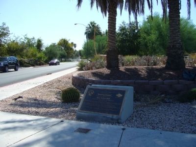
3. Mary Dutton Park Marker
Another marker is no longer nearby. Historic 5th Street School (was approx. 0.4 miles away but has been confirmed missing).
Photographed by Bill Kirchner, September 26, 2011
4. "Breaking Ground"
Sculpture by Steven Liguori
This 14' high stainless steel sculpture depicts a surge of water and 1920's farm plow, symbolizing the fertility of the land.
This 14' high stainless steel sculpture depicts a surge of water and 1920's farm plow, symbolizing the fertility of the land.
Photographed by Bill Kirchner, September 26, 2011
5. NRHP Plaque for the John S. Park Historic District
has been placed on the
National Register
of Historic Places
by the United States
Department of the Interior
1931
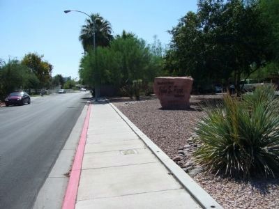
Photographed by Bill Kirchner, September 26, 2011
6. John S. Park Historic District
Credits. This page was last revised on February 7, 2023. It was originally submitted on October 5, 2011, by Bill Kirchner of Tucson, Arizona. This page has been viewed 1,634 times since then and 57 times this year. Photos: 1, 2, 3, 4, 5, 6. submitted on October 5, 2011, by Bill Kirchner of Tucson, Arizona. • Syd Whittle was the editor who published this page.
