Near Camden in Kershaw County, South Carolina — The American South (South Atlantic)
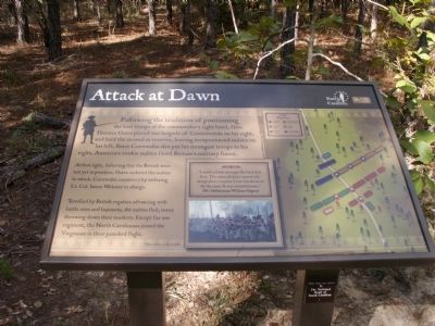
Attack at Dawn
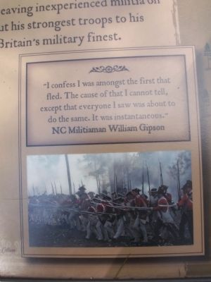
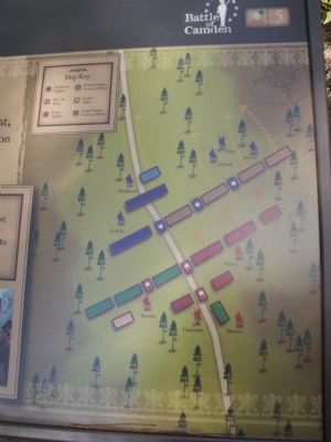
At first light, believing that the British were not yet in position, Gates ordered the militia to attack. Cornwallis countered by ordering Lt. Col. James Webster to charge.
Terrified by British regulars advancing with battle cries and bayonets, the militia fled, many throwing down their muskets. Except for one regiment, the North Carolinians joined the Virginians in their panicked flight.
Erected by The Palmetto Conservation Foundation. (Marker Number 5.)
Topics. This historical marker is listed in this topic list: War, US Revolutionary.
Location. 34° 21.27′ N, 80° 36.421′ W. Marker is near Camden, South Carolina, in Kershaw County. Marker can be reached from Flat Rock Road (State Highway 58). 6.2 miles North of Camden off US 521 and 601 on SC 58. Touch for map. Marker is in this post office area: Camden SC 29020, United States of America. Touch for directions.
Other nearby markers. At least 8 other markers are within walking distance of this marker. All the King's Men (about 300 feet away, measured in a direct line); Meet the American Army of 1780 (about 700 feet away); Charge and Countercharge (about 700 feet away); Shots in the Dark (approx. 0.2 miles away); Defeat in the Center (approx. 0.2 miles away); The Road to Battle (approx. ¼ mile away); General Gate's Disgrace (approx. ¼ mile away); Panic and Valor (approx. ¼ mile away). Touch for a list and map of all markers in Camden.
More about this marker. This marker is part of an interpretive trail series at the Battle of Camden National Historic Landmark.
Credits. This page was last revised on June 16, 2016. It was originally submitted on October 9, 2011, by Anna Inbody of Columbia, South Carolina. This page has been viewed 626 times since then and 16 times this year. Photos: 1, 2, 3, 4. submitted on October 9, 2011, by Anna Inbody of Columbia, South Carolina. • Craig Swain was the editor who published this page.


